
We’ve covered most of the coastal walks around Nice, and now have begun to search out hikes that are in the hills behind Cote d’Azur. Our first was behind the hilltop town of Gourdon, where there’s a bluff that overlooks the town and provides a very panoramic view of the coast and Mediterranean.
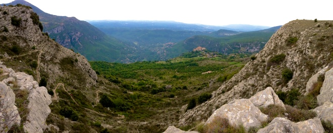
The name of the trail (you can see if snaking up in the photo above to the left) is the Plateau de Cavillore and it is accessible right from the parking lot below the entrance to Gourdon. Cross the street and look for the sign a little ways up highway RD12, about 50 meters. Continue to follow the signs and look for the yellow markings that mark the trail. It takes about an hour to get to the top and the hike up is about 300 meters in elevation and three kilometers in distance. It is marked as a “medium” level hike.
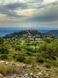
On your return be sure to have lunch at the Taverne Provencale, which is in Gourdon and has wonderful panoramic views from most tables. Walk right through Gourdon’s main street to the end to get to it. Our favorite meal is the Salade Chèvre Chaud (Hot goat cheese salad), which is the best we’ve ever had; very unique and their house specialty.

To get to Gourdon, take the A8 out of Nice, over the bridge and the exit for La Colle sur Loup. From there take the D6, following the signs marked for Gourdon. You may want to take the other route back, which passes through Grasse. The drive both ways is a great one, especially in the fall when the leaves are turning color.


0 Replies to “Plateau de Cavillore Hike at Gourdon, France”