In years past I would hire an airplane so I could take aerial images of the Puerto Vallarta region for our print and online publications. When the market was hot I’d have to go up each year as so much would’ve changed because of real estate development. That said, I hadn’t been up since 2010 as the market in Vallarta really leveled off. But it is in full swing again, so it was time to update our aerial image bank. Even though I no longer have the print business, we did keep our MLS service and we make good use of the aerial images there.
In the past I’d usually go up in a small Cessna where the door had been taken off in order to get better quality images. I’d strap myself in well and then hang out, in order not to get the wing in the images. The pilots I flew with got good at helping me out by flying sideways and lifting the wing, giving me a better angle.
But this year I decided to invest the money I’d spend on plane time into a drone instead, and keep myself safe on the ground. It has given me a lot more flexibility to the type of images I can take, and when I can take them. And it is a lot less expensive.
I prefer panoramic images as they look great on full screen websites, and better reflect what a region looks like. To get these images there is a built-in Pano builder that comes with the software of the Mavic Pro, but I’m not happy with the quality it provides for the finished end product. So I build my own by taking 4-8 vertical images that I overlap by about 25%, and then stitch together using Adobe Photoshop Elements. I’ve tried a few programs that stitch images together but found that Elements definitely does the best job. And the price is right at just $75.00. It is easy to use and rarely do I have to make any further adjustments, except to the lighting, contrast, sharpening and color.
Unfortunately the format I use for this blog doesn’t do these images justice. If you want to see them in a larger format, with information about each development, visit mlsvallarta.com.
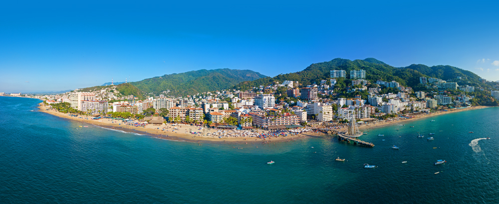
Downtown Puerto Vallarta
With the “Malecon” promenade in the foreground and the church and plaza behind.

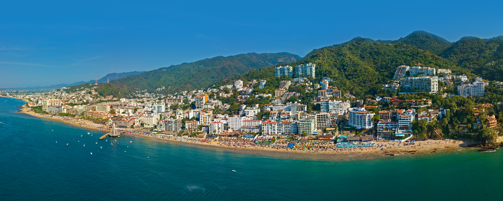
Southside Vallarta
With the new pier and the popular Los Muertos beach in the foreground, and the hillsides of Amapas behind.
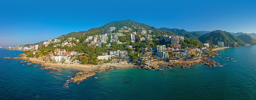
Conchas Chinas
This coastline reminds me of the Cote d’Azur, although with a few more high-rises…
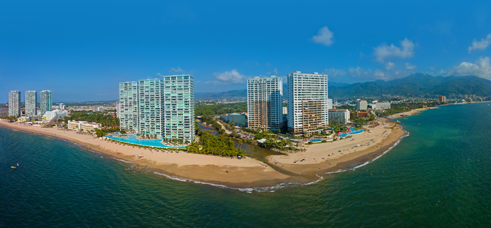
Hotel Zone
A little to the northwest of Vallarta, and before the airport, is the Hotel Zone, which saw a number of residential high-rises go up between 2003-2010.
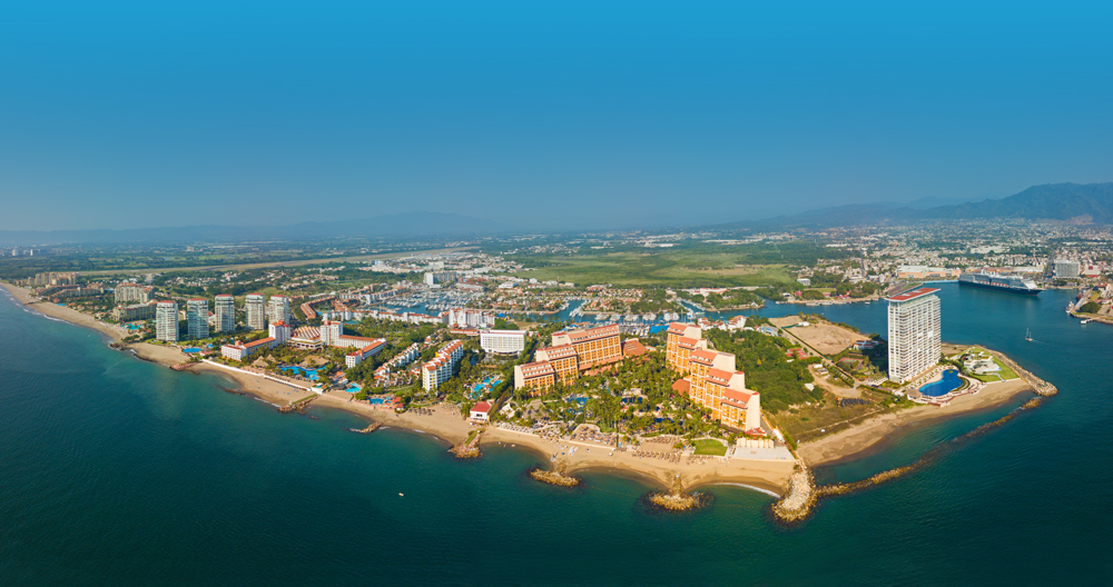
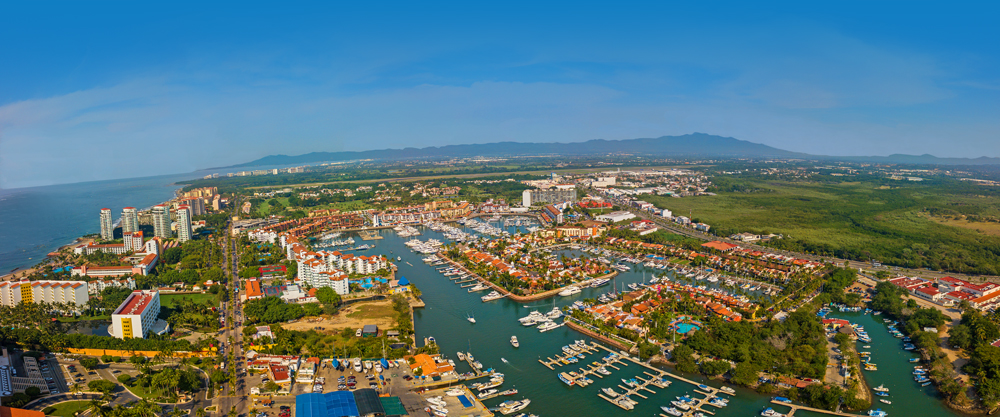
Marina Vallarta
One of Mexico’s first mega-developments with a golf course, marina and plenty of real estate and stay options.
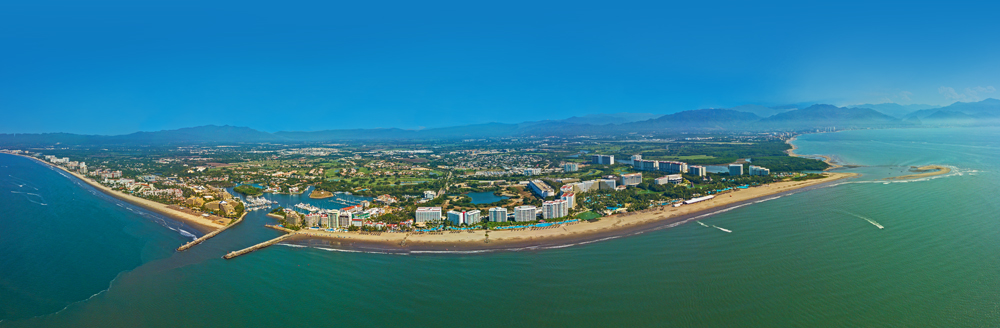
Nuevo Vallarta
Vallarta’s second mega development with four golf courses, two marinas, and lots of real estate options available.
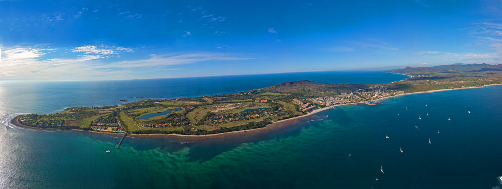
Punta Mita
A very high-end real estate development on the most northerly point of Banderas Bay.
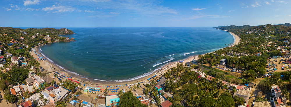
Sayulita
A very popular and funky surf town to the north of Vallarta.
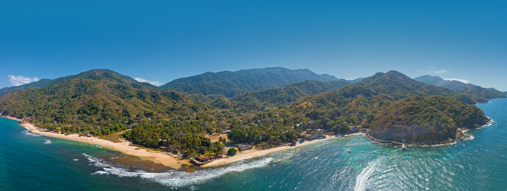
Quimixto
A favorite getaway of ours, with a nice left-break surf spot, situated on the south shore of Banderas Bay.