

We’d been wanting to visit Madeira ever since our first visit Portugal some five years ago and learned that the island group was also part of Portugal (along with the Azores). Covid caused us to cancel our planned trip last year, but in March we decided to try again as Madeira was open to Portuguese residents only as long as you’d recently had a Covid test done. Our flight from Lisbon was just a little over two hours and we arrived to wonderful weather, about 20º (the average temperature throughout the year) with bright, clear blue skies. Madeira’s weather is similar to parts of thew Med with a mild and moderate subtropical climate. It varies dramatically, however from north to south and east to west creating small microclimates. The northwest is much wetter whereas the southwest is arid and dry.
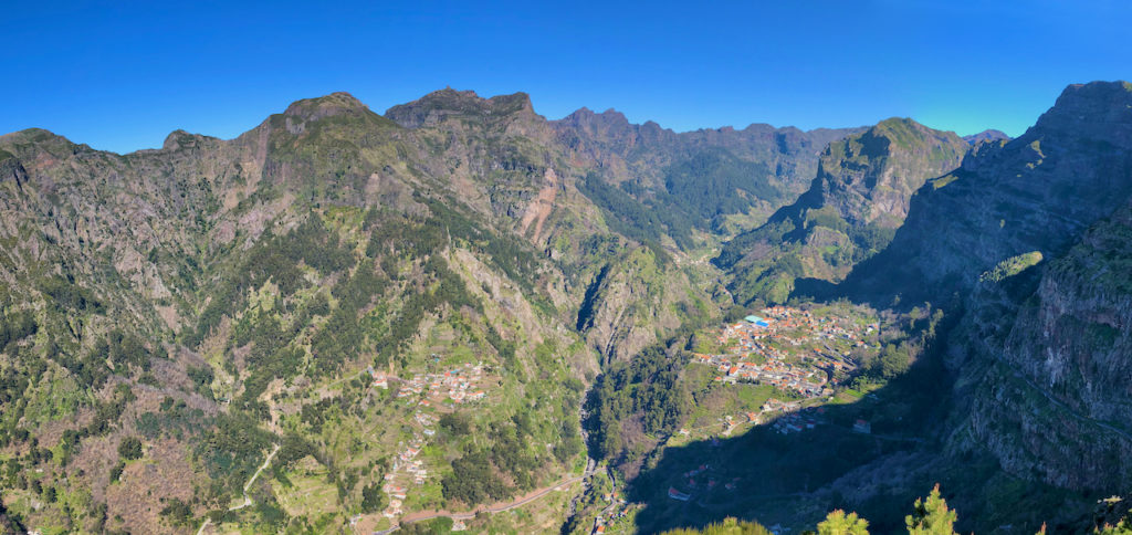
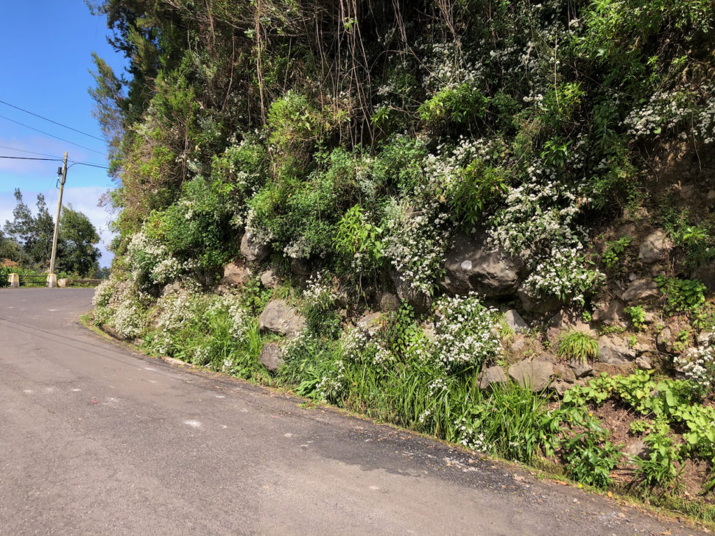
Madeira an archipelago that consists of the three islands – Madeira, Porto Santo and Desertas, with an overall population of less than 300,000. It’s situated a 1,000 km south of Portugal’s mainland and about 500 km off the coast of Morocco. Because of its volcanic origin it has a very rugged landscape that’s never monotonous, with high mountains and deep valleys in varying shades of green. On top of that are exotic flowers that dot the landscape in a myriad of colors.
It is basically one steep volcanic mountain range that juts out of the ocean leaving little flat terrain. For the airport they had to build up the land at one end and at the other construct a huge elevated concreate platform to support the landing strip. Nearly all of the farming is done on the sides of the mountain in steps, held in by rock walls to level off the land. Living in Madeira means if you aren’t going up then you’re going down, with little in between!
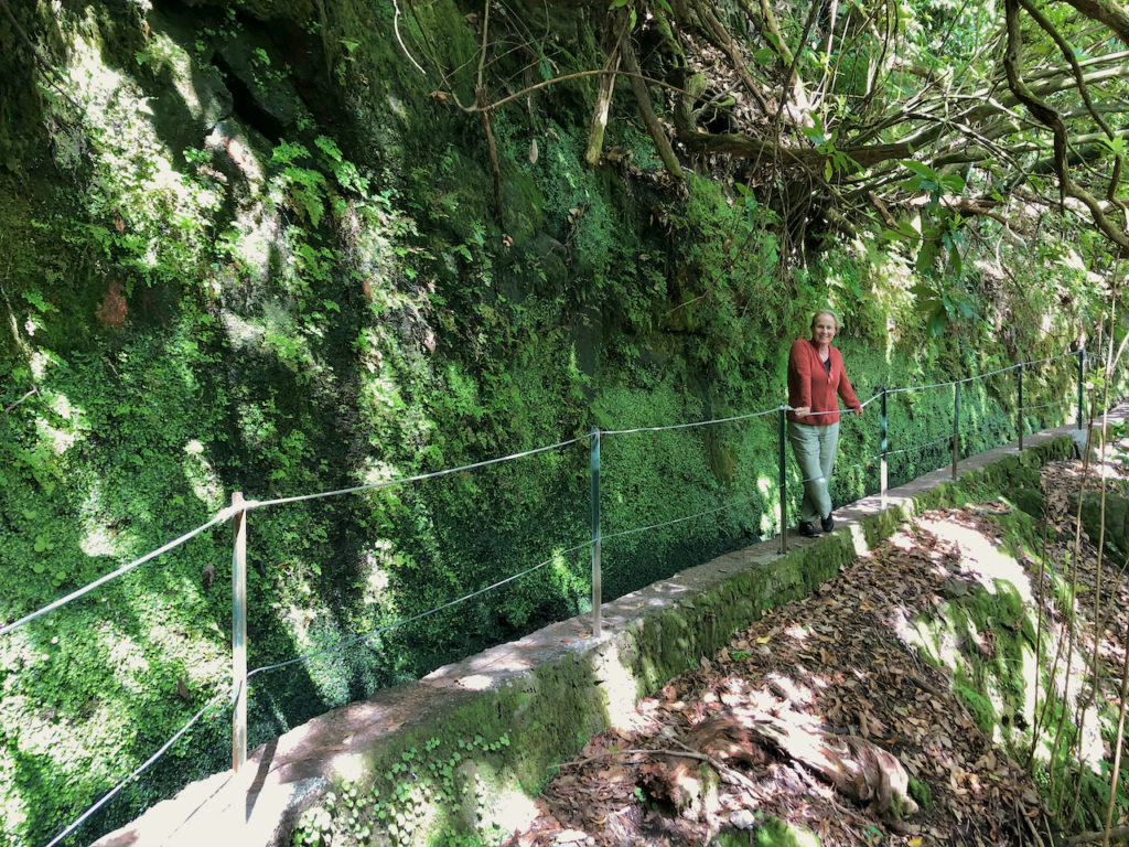
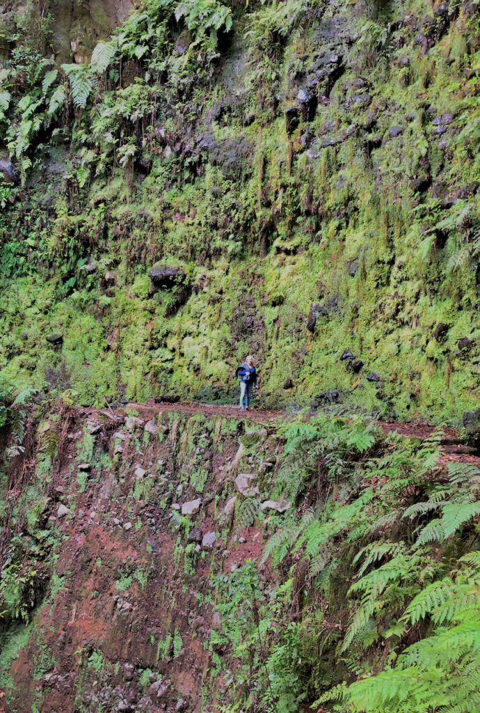
As there’s so much vertical on the island every highway, road, trail and levada has at least one side where they’ve had to cut into the mountainside and build a retaining wall of rock or concrete. With time these walls have become beauitful natural vertical gardens creating covered in moss, ferns, plants and flowers as nature reclaims the space.
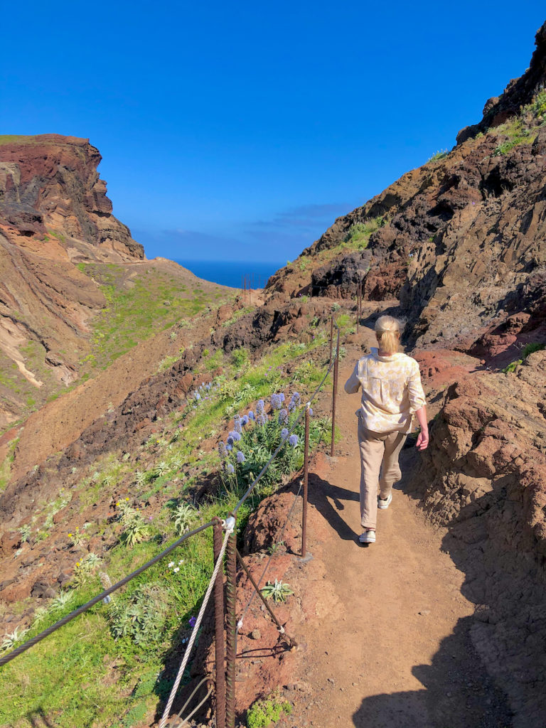
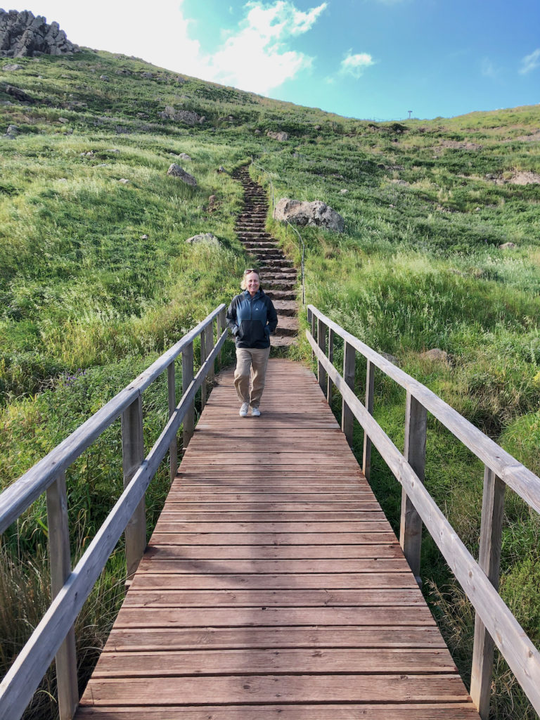
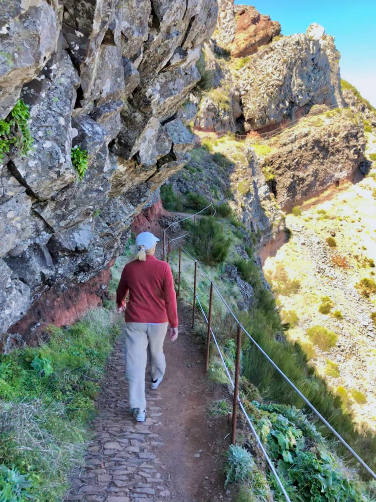
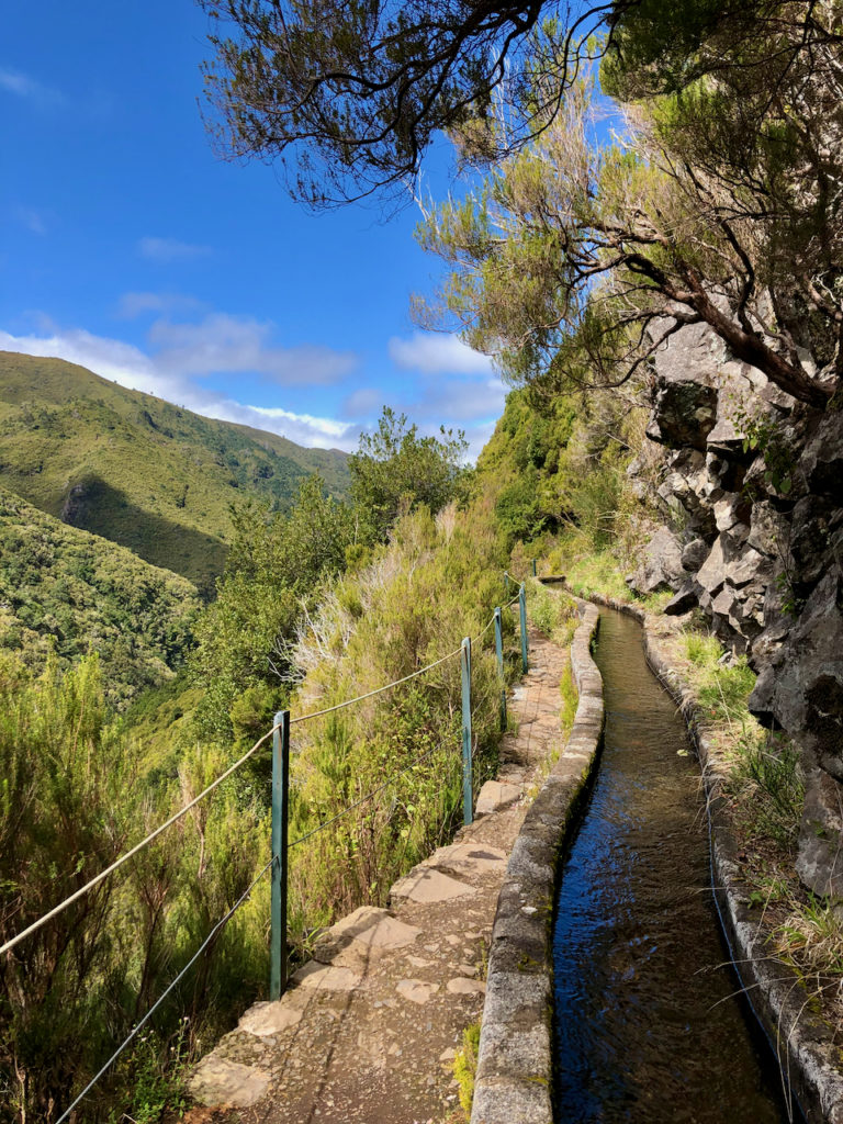
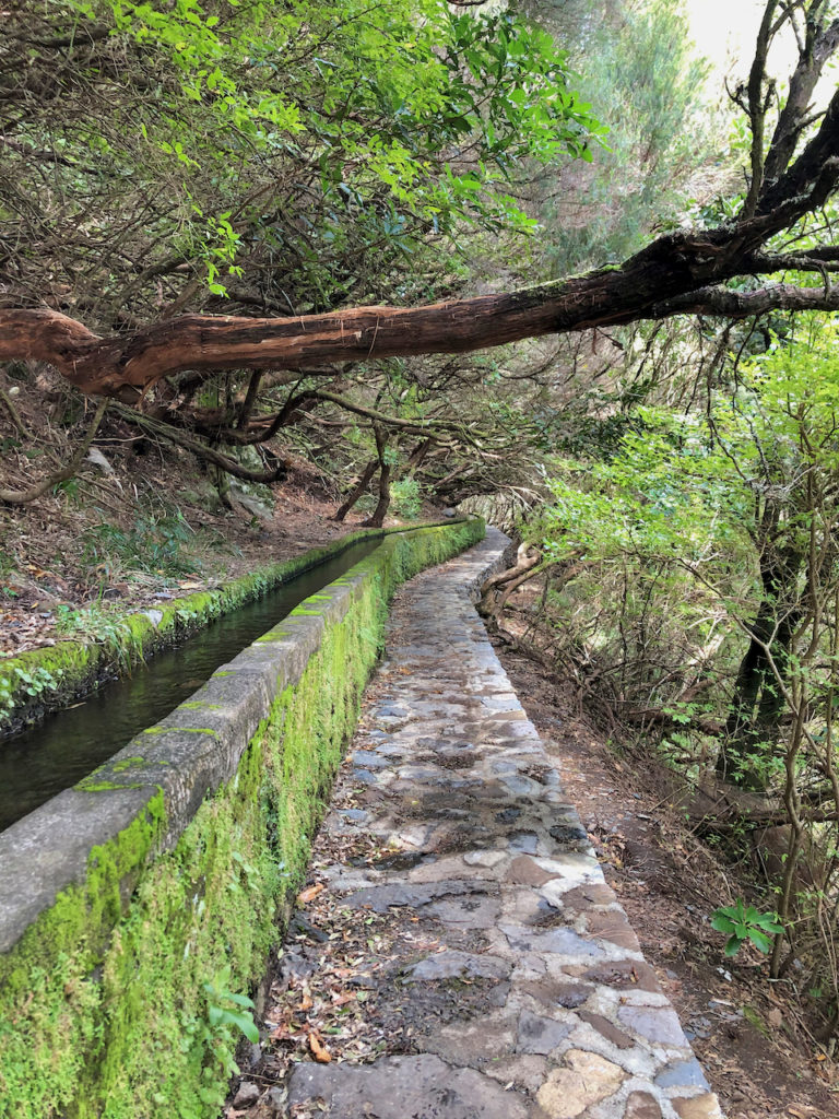
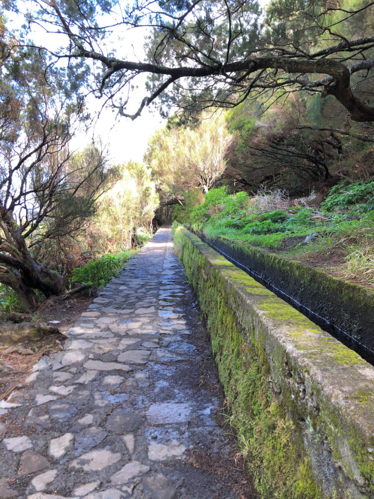
We enjoyed the “levada” hikes most during our time on Madeira. During the 16th century the Portuguese started building canals, or levadas, to carry water to the agricultural regions in the southeast. With its steep mountains the building of the levadas, often using convicts or slaves from Africa, was difficult and treacherous. Many of the mountains have a nearly vertical cliff face and onto this the levada builders had to cut away a path to carry the water, which was used to or irrigations and to power windmills for sugar cane cultivation. Years later the sugar industry collapsed so the levadas were hardly used or maintained. But then the Madeirans came upon another use – hiking paths for tourists. Today there are about 200 levadas stretching 2,200 km across the island with some now also being used to provide electricity through hydro power. Over our seven days we did five hikes, three of which followed a levada.
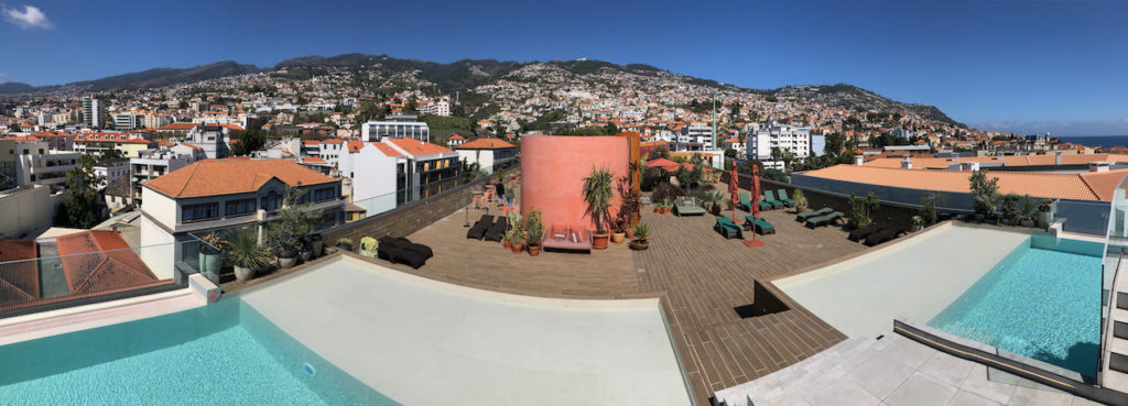
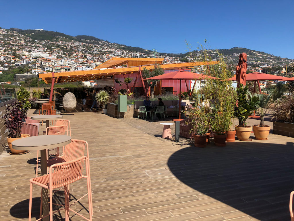
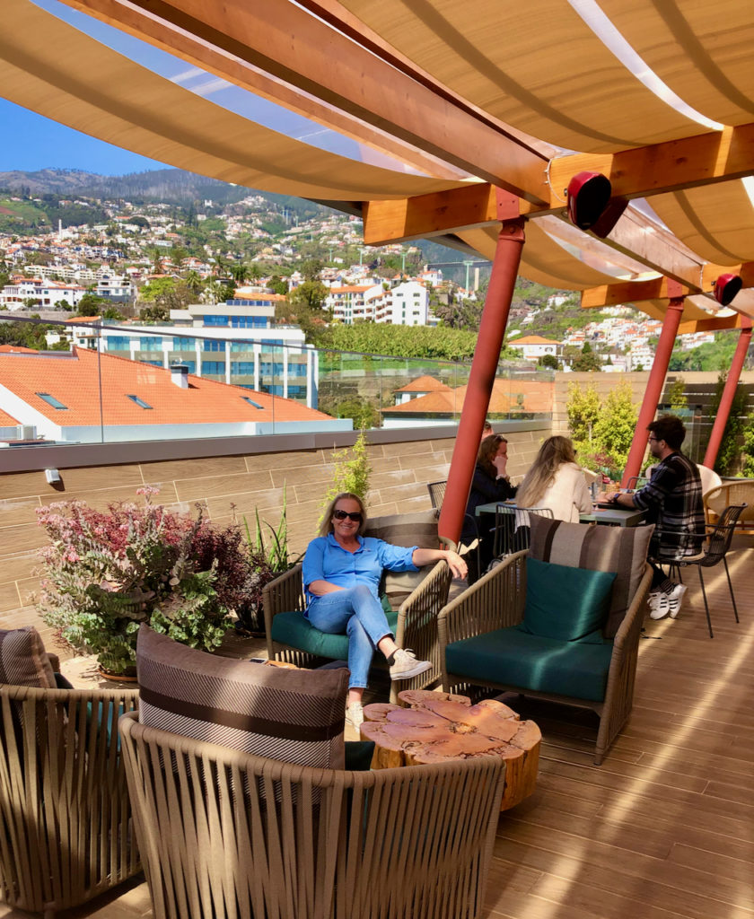
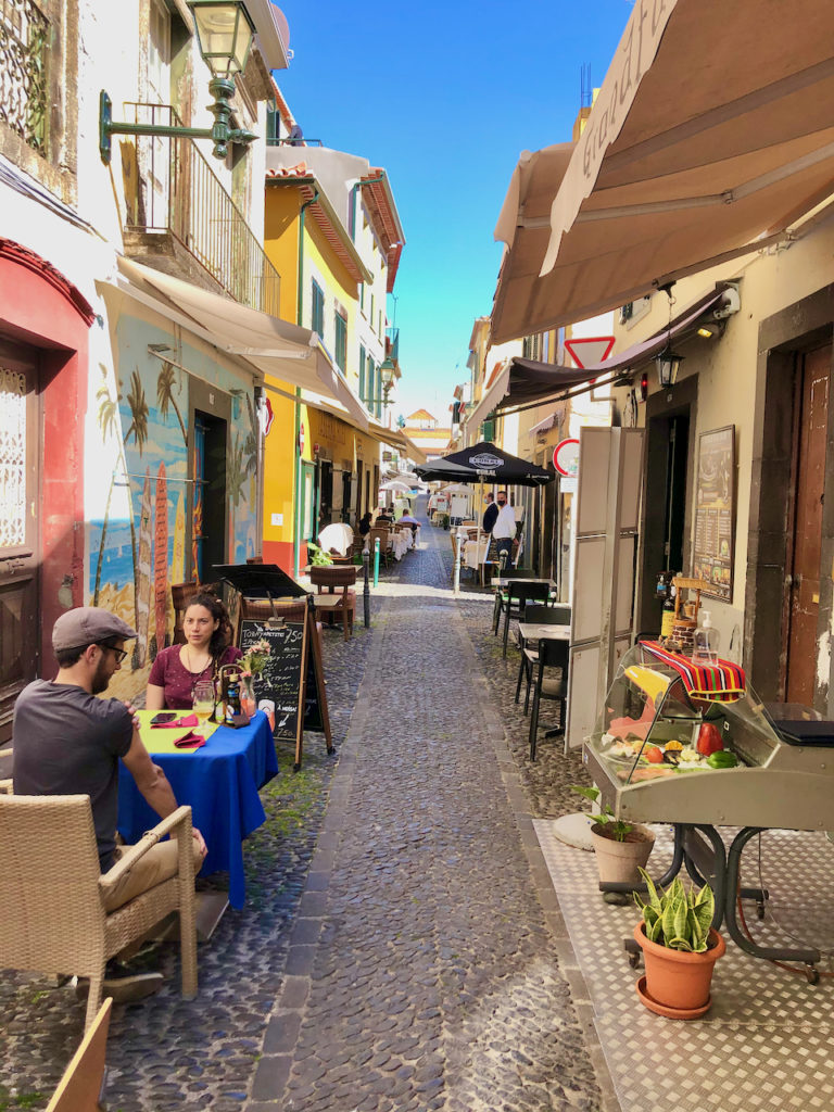
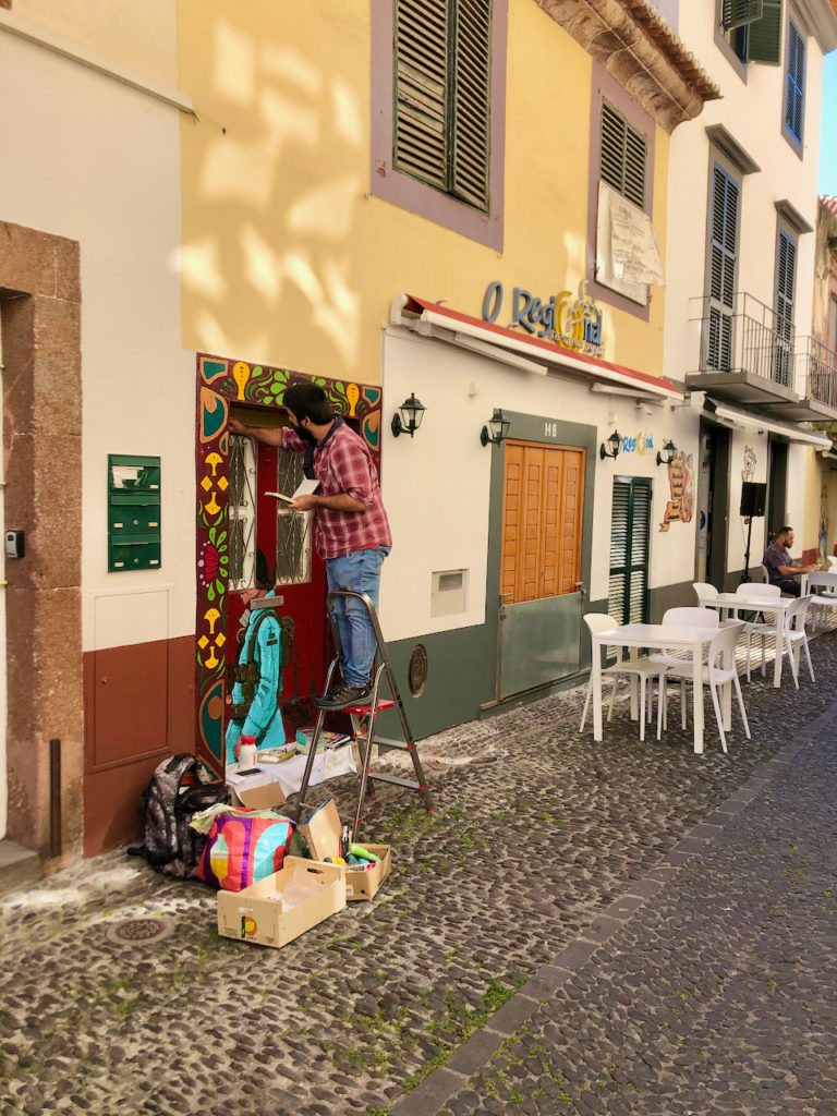
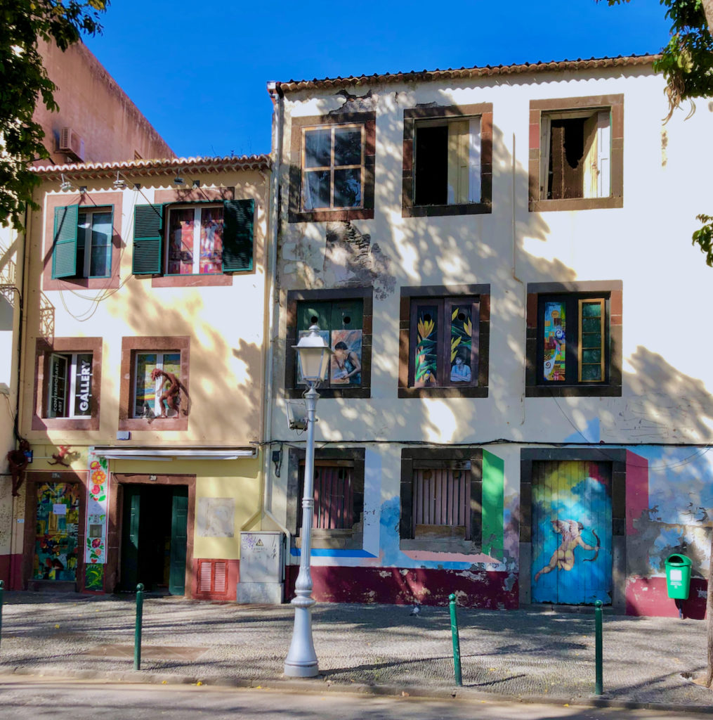
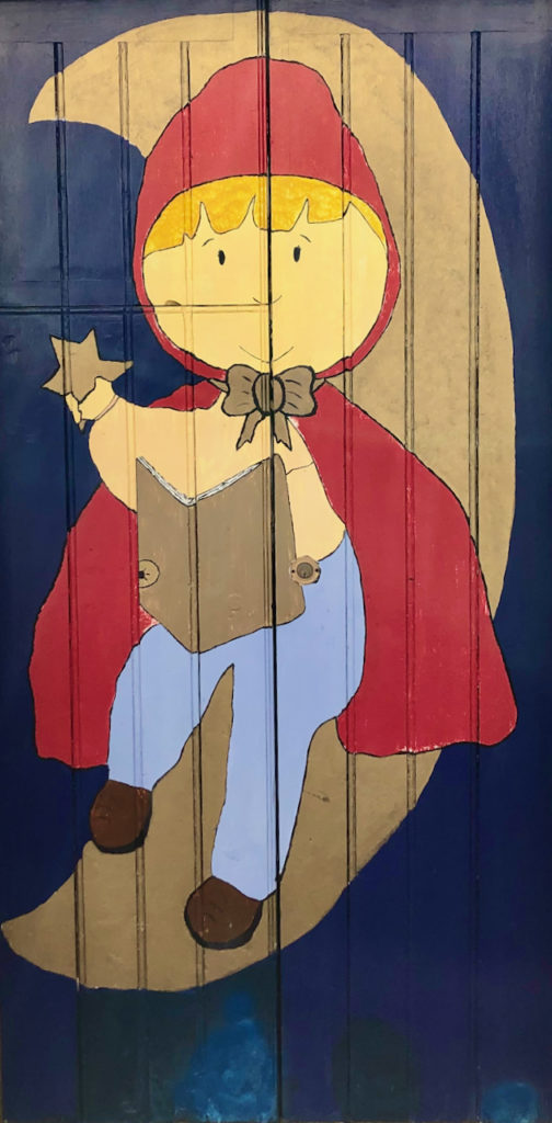
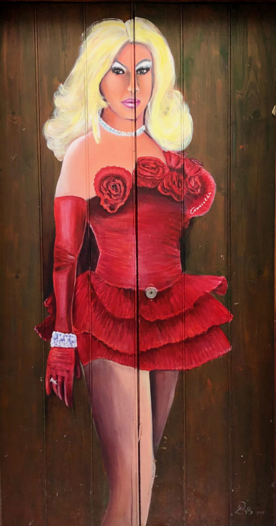
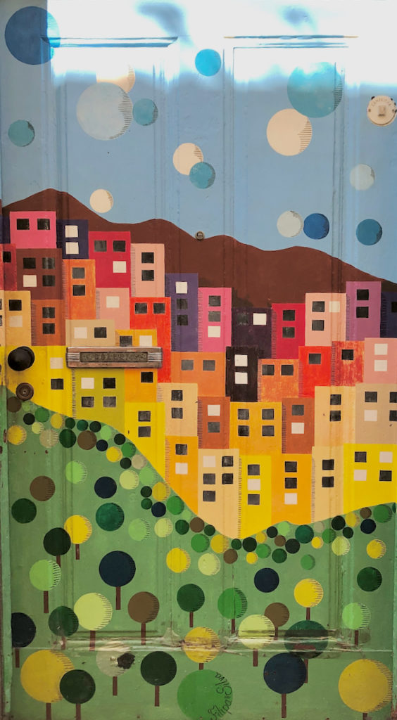
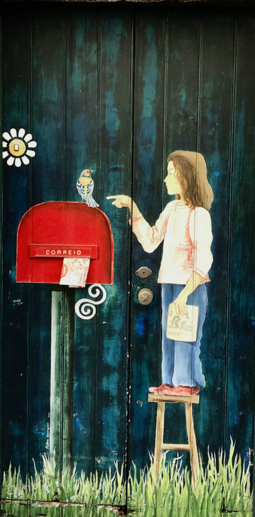
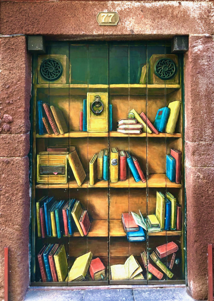
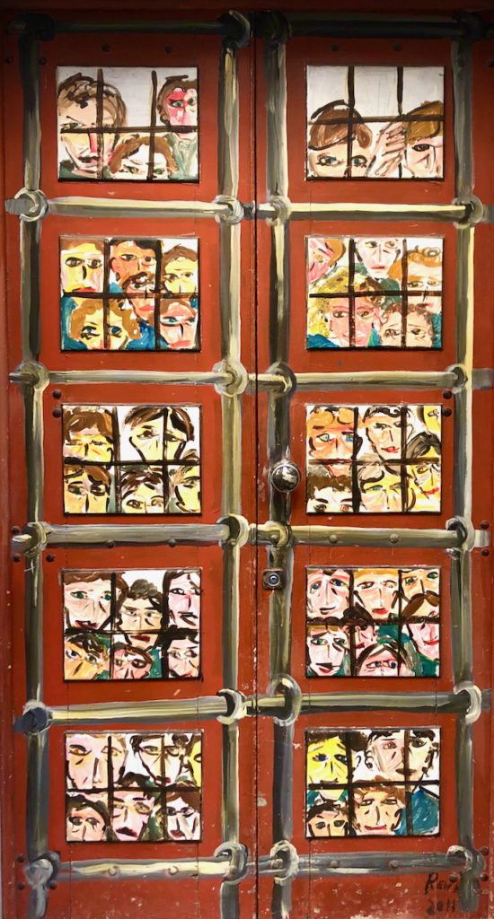
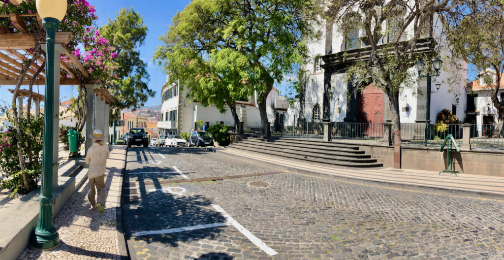
We spent our time just on the main island of Madeira with three days in the capital city of Funchal, two days near Curral das Freiras in the mountains, and our final two days in Porto Moniz on its far northwest corner. Funchal is the largest city on the island, perhaps the only city as the others are really small towns or villages. Our hotel was right in the center making it easy to explore the downtown area and oceanfront. Our favorite street was Rua da Santa Maria with its painted doors and small restaurants, which follows the shoreline to a viewpoint east of town where there’s a swimming platform and the very popular (and good) restaurant/cafe Barreirinha.
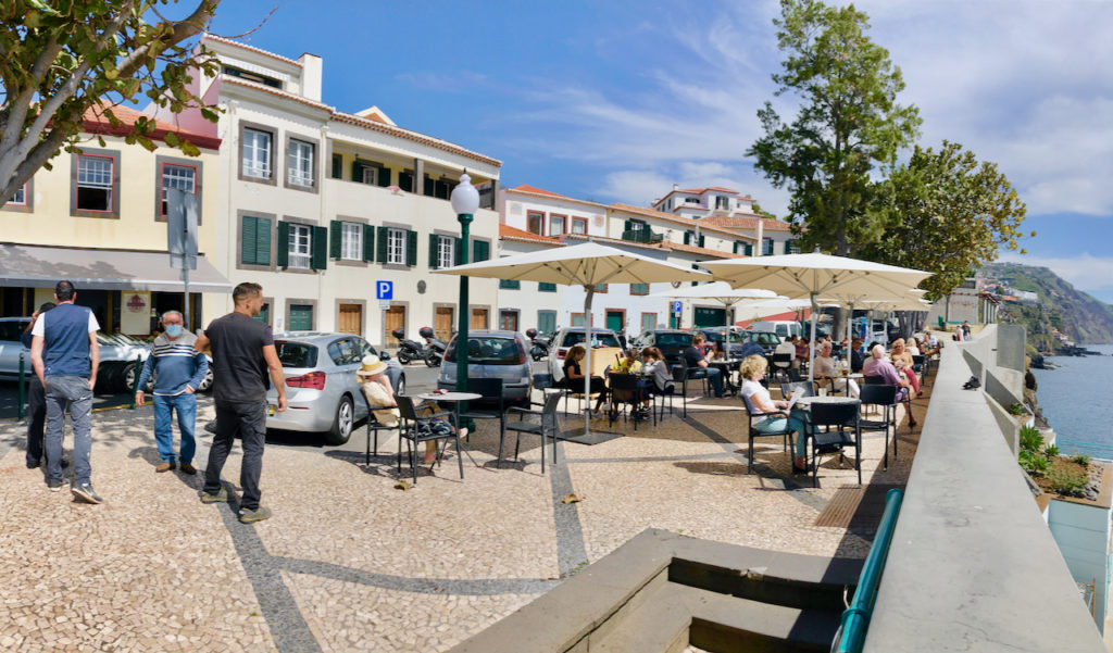
The next day we took the coastal rode west from Funchal to Cabo Girao. On the way we past through small towns, stopping at Camara de Lobos, a small fishing village, to walk their seaside promenade.
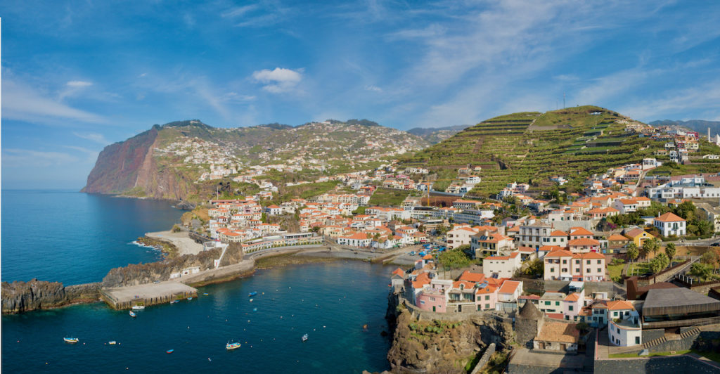
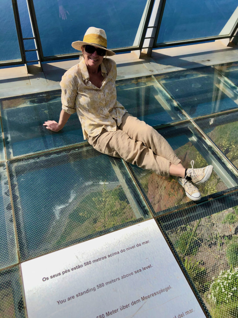
Cabo Girao offers a viewpoint perched on a cliff that drops straight down. A portion of the viewpoint is made of plexiglass so you can look down at the beach and sea far below. The views are dramatic, looking back towards Funchal. At Girao there were only two other couples, but you could tell from the way it was designed, it was to handle a lot of people, with large parking spaces for tourist buses in front. So, we had Madeira pretty well to ourselves!
Getting around the island is best done by car as you don’t want to be on any of the main highways on a scooter, at least I wouldn’t. The main one, the VR-1, is two lanes – offering really slow and really fast. In the slow lane are large trucks that have difficulty getting up the many hills that have to be climated while in the fast lane are the locals, seemingly always in a hurry to get somewhere fast. And the on raps entering onto these highways that circumnavigation the island are very short, which also makes driving here challenging. Because of the terrain the highways are made up of mostly bridges and tunnels – meaning if you aren’t going over a hill, you are going through it.
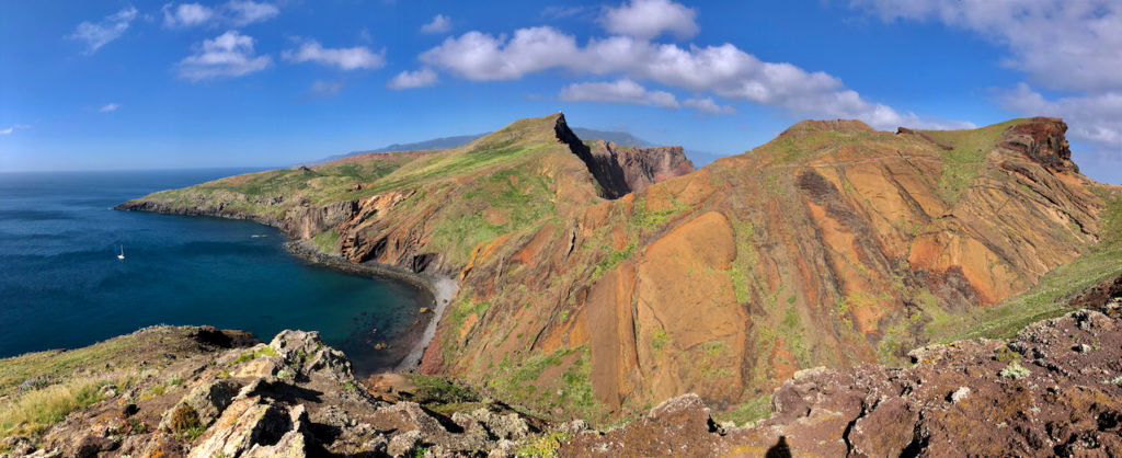
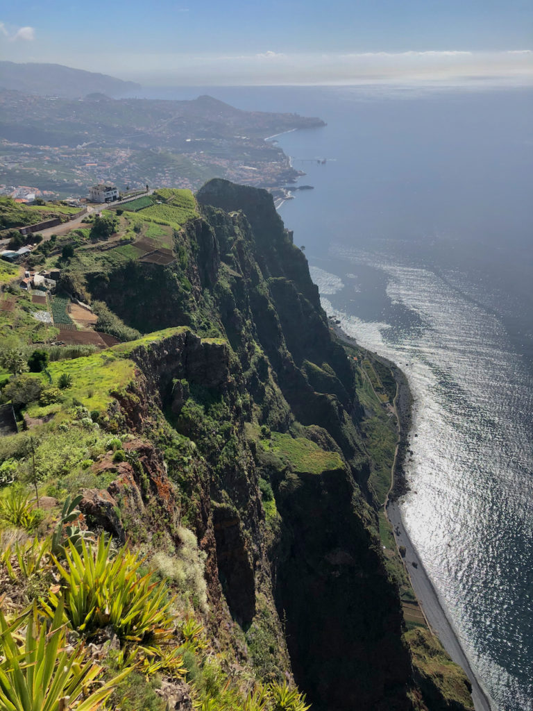
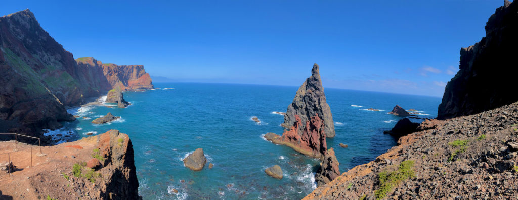
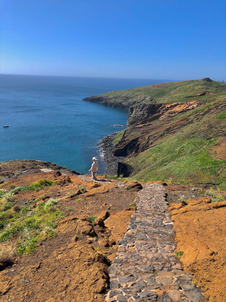
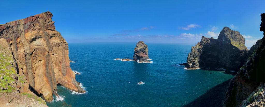
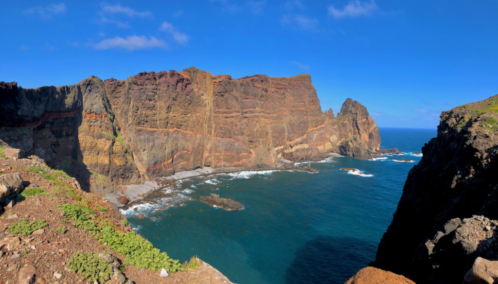
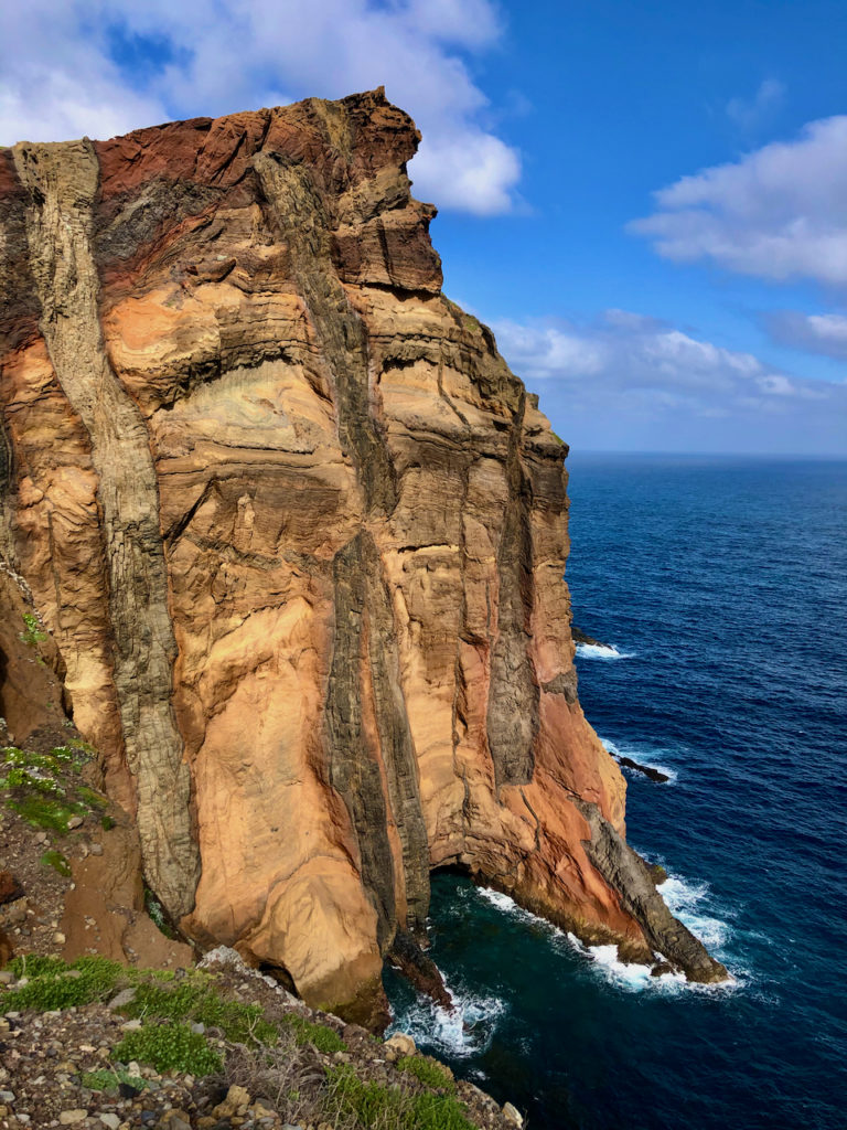
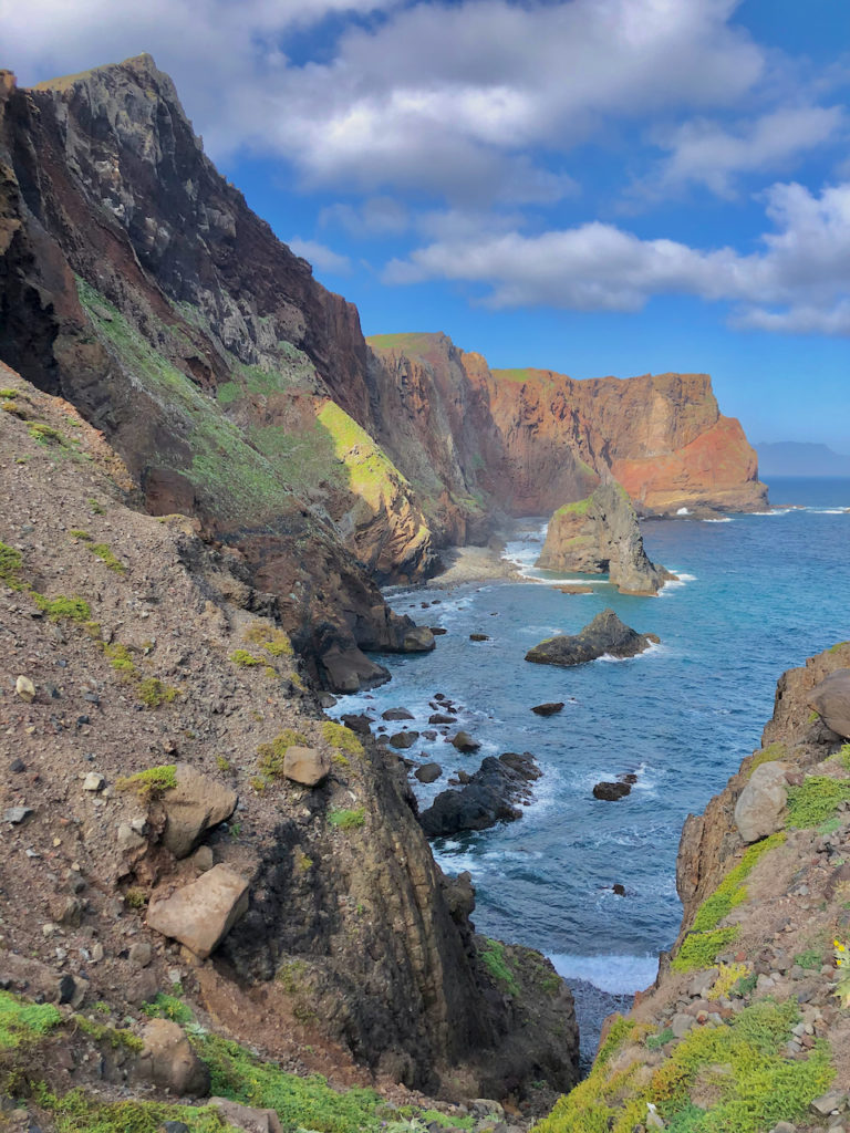
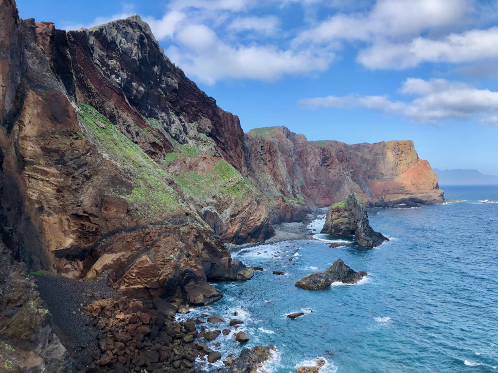
The following day we headed east to the far end of the island to hike the Vereda da Ponta de São Lourenço trail. Here, the island narrows into a long peninsula but it still is draped in steep hills that dramatically descend into the ocean below. There is little in the way of vegetation as it quite dry, creating a barren landscape except for many colored desert-type flowers. The trail ascends and descends as it stretches out to the far eastern point, providing spectacular panoramic views along the way.
Eira do Serrado – Curral das Freiras
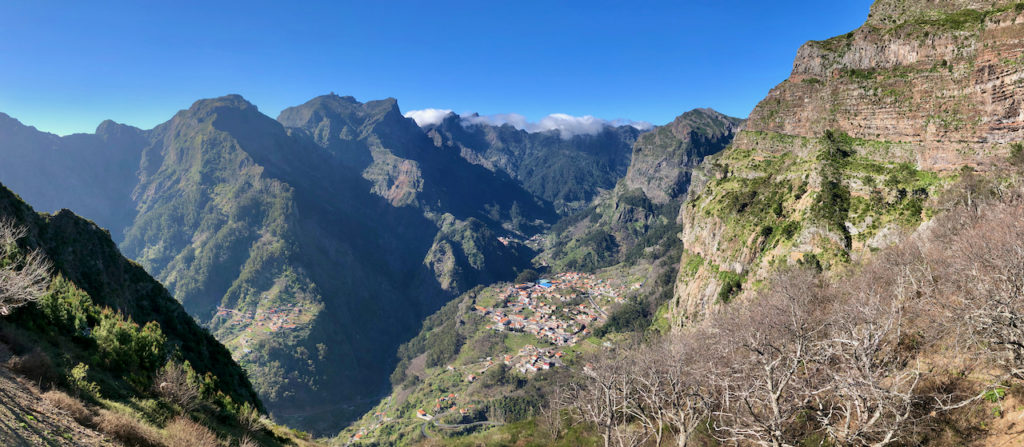
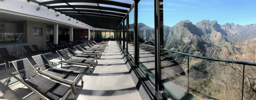
On our fourth day in Funchal we left our condo/hotel and headed to our next hotel, Eira do Serrado, that’s high in the mountains behind Funchal, close to the Serrado viewpoint that looks down upon the town of Curral das Freiras. The hotel has incredible views from all parts of the hotel, the most amazing being from the dining room and swimming pool area.
And we were the only ones in the hotel. Rather strange having all the hotel staff there just for us. At breakfast and at dinner we could watch the clouds roll over the mountain peaks and make their way down the mountain, slowly dissipating before reaching the village of Curral das Freias. In the morning there was sun on the front of the hotel at sunrise, but for the village of Curral it can take another couple of hours before it reaches the town. As we had breakfast we could watch the shadows slowly make their way down the mountainside as the sun climbed further into the sky. And then over dinner we watched shadows return and slowly make their way up the mountainside.
Curral is completely surrounded by mountains except for a narrow passage that leads up from the south. It was originally settled by nuns who went there to escape marauding pirates. Today it is known as the Valley of the Nuns.
We checked into our room, left our bags and then drove up to Areeiro, one of the highest points of the island. Flo and I together walked down to a viewpoint that looked northward, while I continued on later to look for photo opportunities. The hike continues on to Pico Ruivo.
The drive up to Pico Areeiro from Eira do Serrado is on a narrow secondary road that has a very steep grade. Our little Fiat didn’t have much power, but to get up much of it I had to put the car in first gear and had to be careful not to overheat the engine, keeping RPMs at around 3,000. Which meant going up very slowly, under 20 km. And when we came down later in the afternoon, I could smell the brake pads burning.
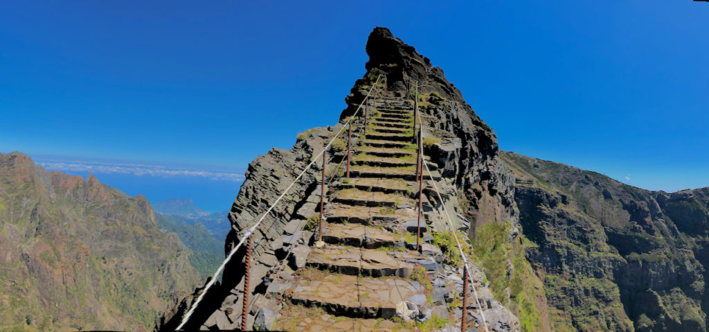
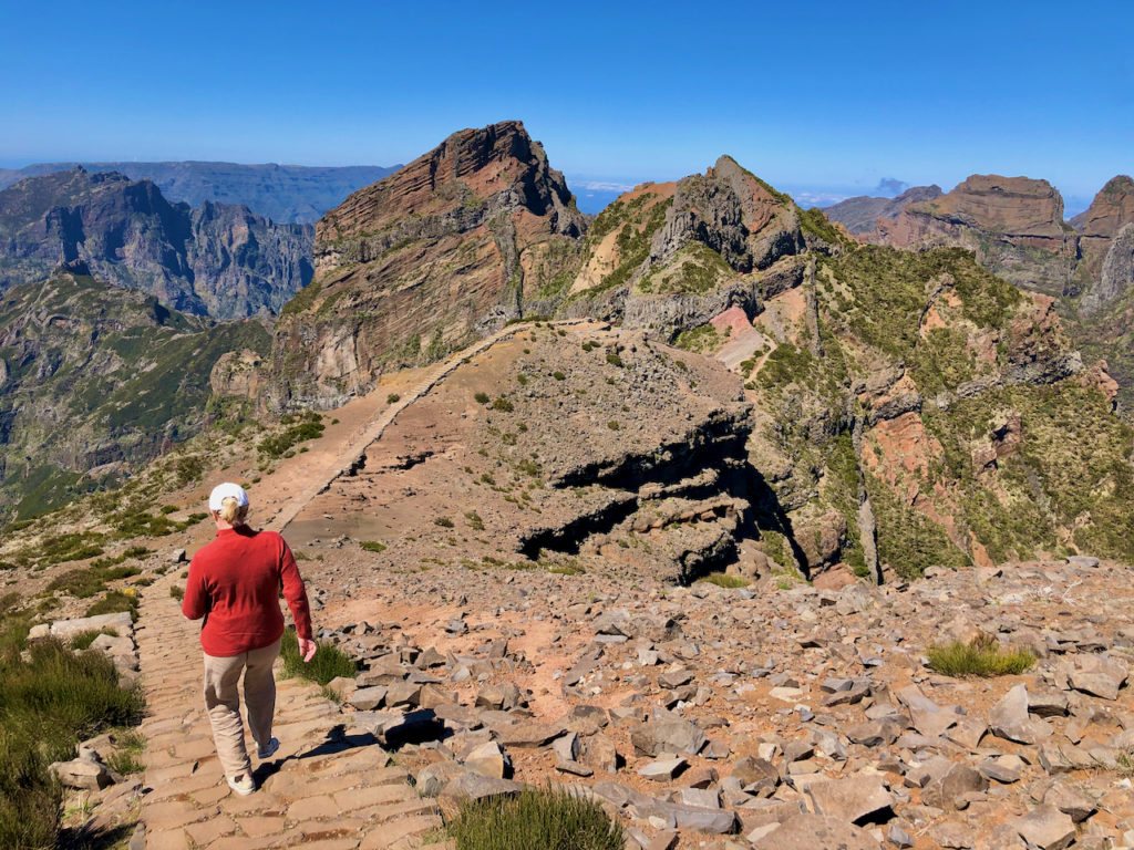
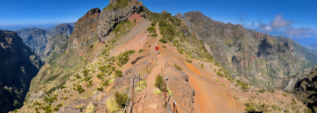
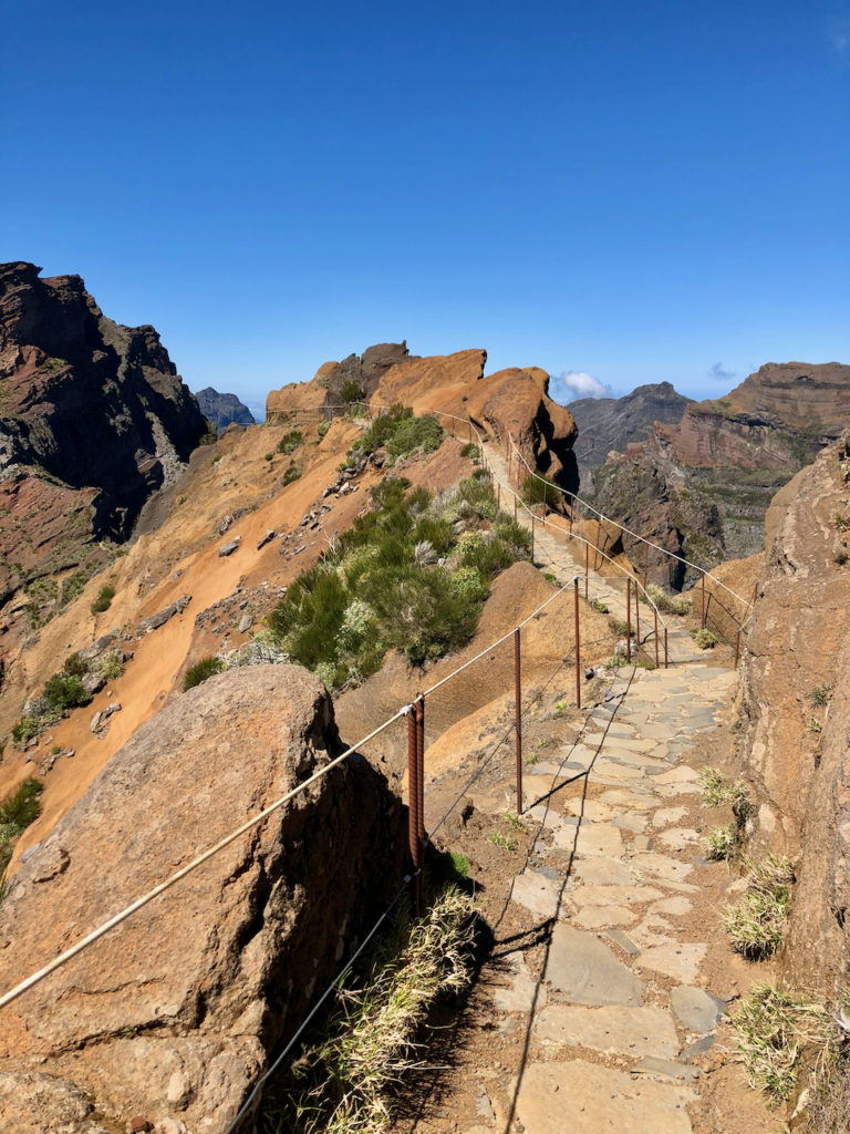
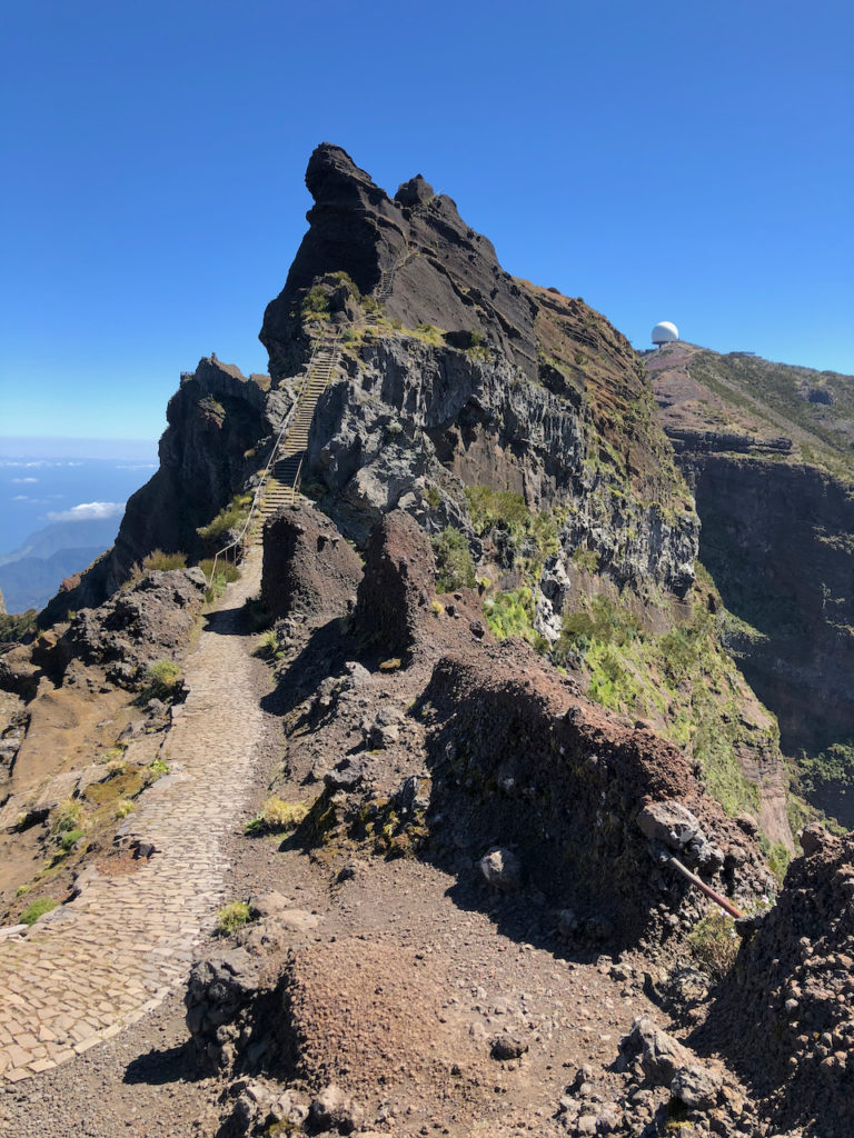
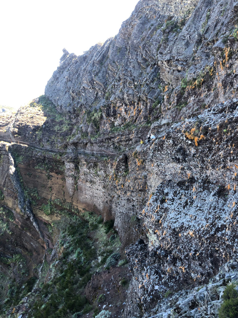
There are a number of places on the Areerio/Ruivo hike where you are walking along a path that is on the crevasse edge of a mountain, with both sides falling down for hundreds of meters. The path has safety wires on each side and is made up of rock and concrete steps, although it still makes for a rather uneasy, but exhilarating hike. I followed it to and around Pedra Rija peak, and then descended down the side of the mountain, with the path meandering back and forth on the side of a cliff.
At the bottom it levels out and then passes through a large rock pinnacle via a tunnel, then opens up to another peak on the other side and the commencement of the climb up to Pico Ruivo. To do this whole hike can take 4-5 hours, there and back. Too much for me as I had Flo waiting for me so I turned back at the halfway point and started the climb back up. It was difficult, mostly stairs, and I could hear my heart racing. So I took my time, but it was a long climb. But what views and what a pathway! One of the more challenging hikes on the island.
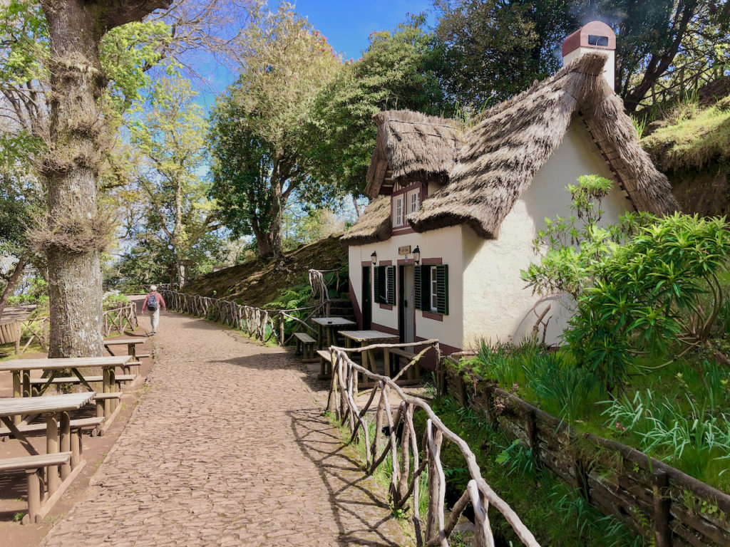
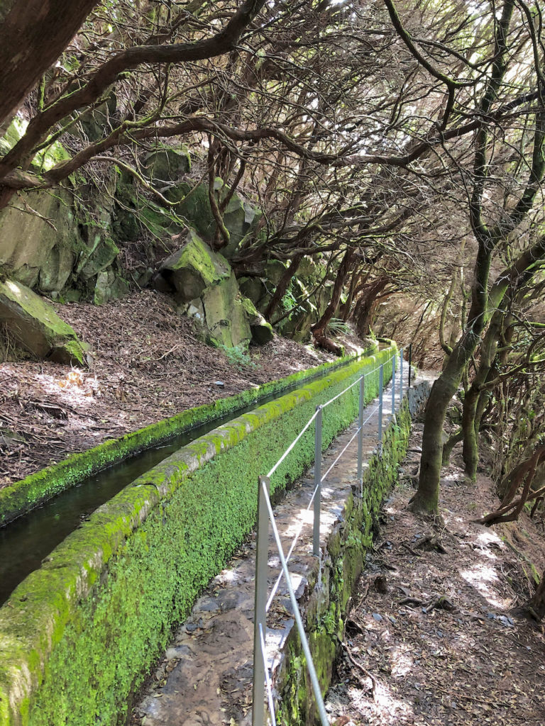
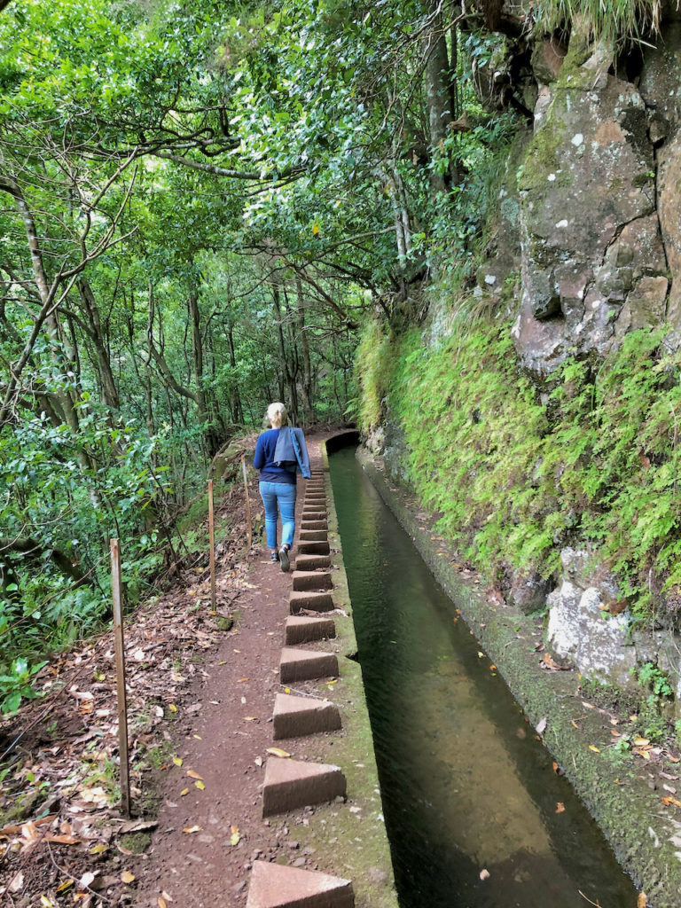
The next day we took the road up to Areerio again and then down passed Ribeiro Frio, through the town of Santana on the northside of the island, and then back up another valley to reach the hiking area of Queimadas. This hike follows a “Levada,” a narrow water irrigation link from a source high in the mountains, made from the rock they had to cut out from the mountainside for the levada route. It is set at a grade so that the water it carries slowly makes its way down to a village and crop region. They are perfect, with their low inclination, for hikes. And they pass through rich foliage and some dramatic scenery.
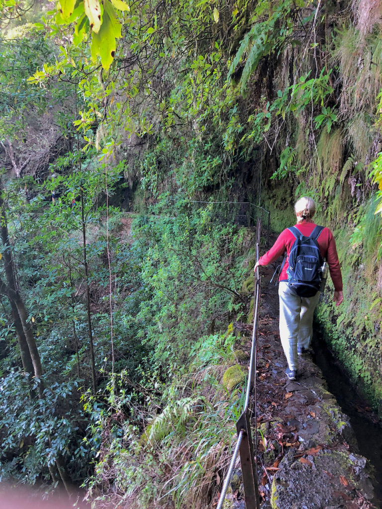
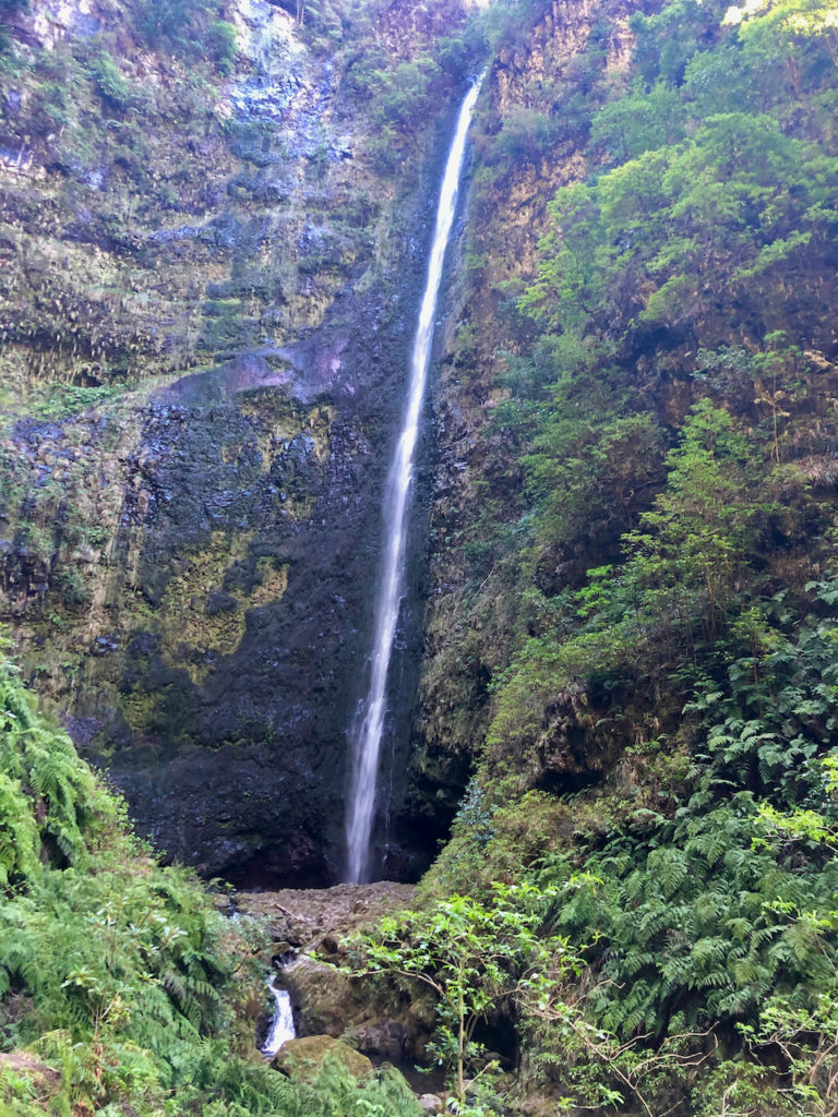
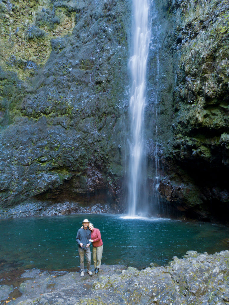
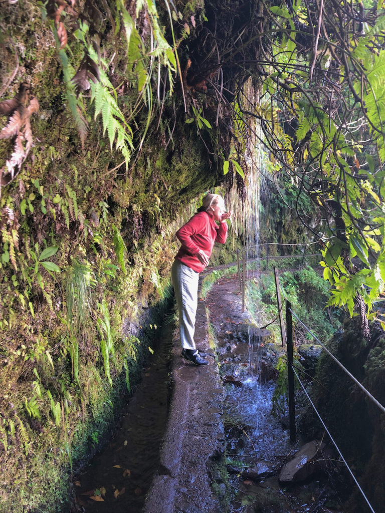
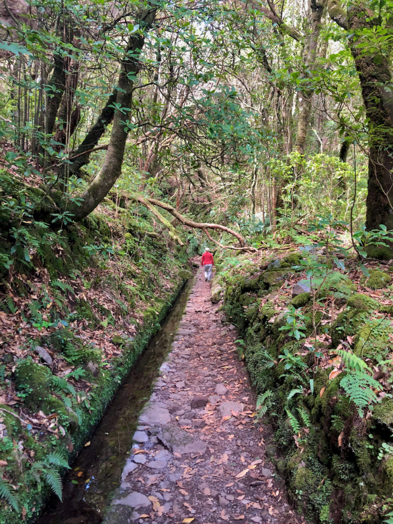
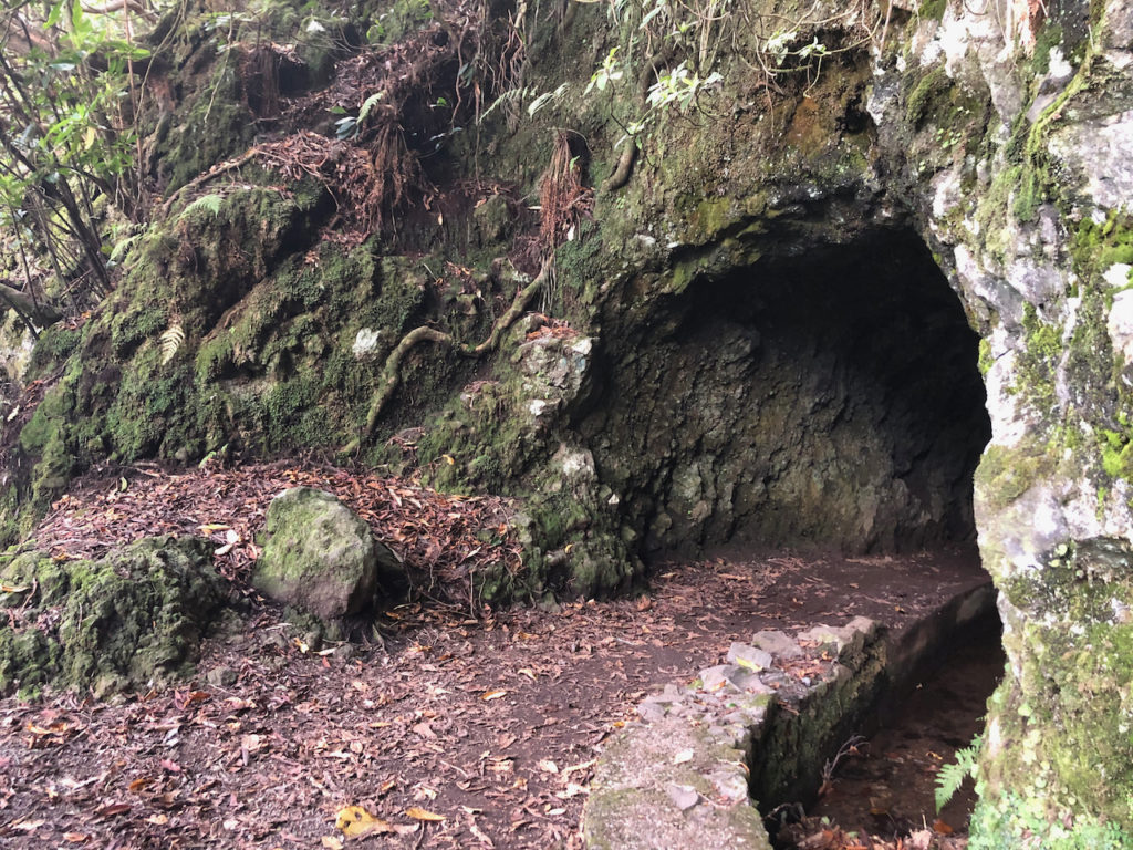
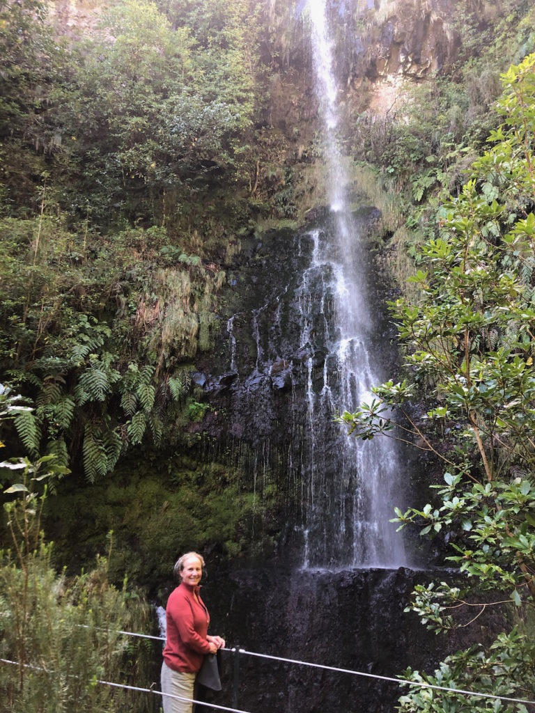
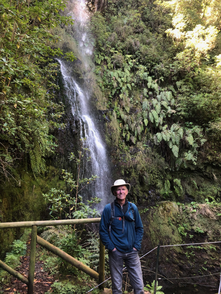
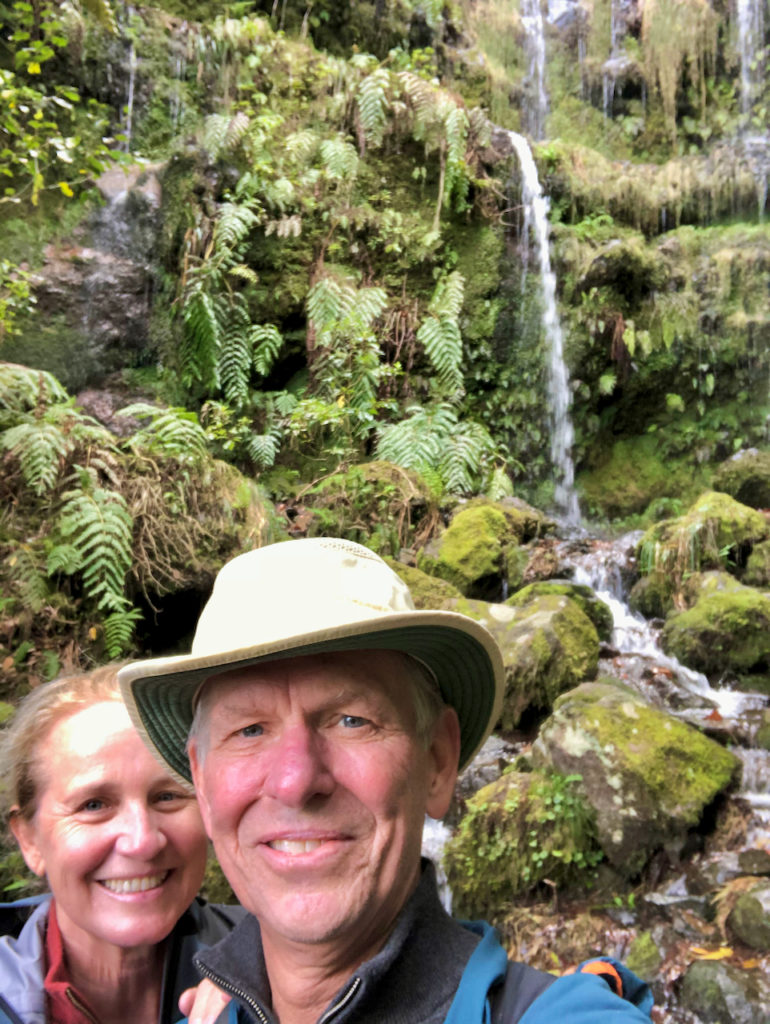
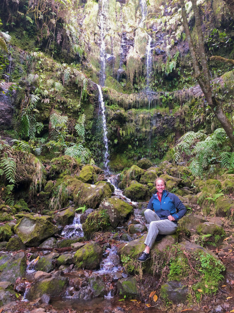
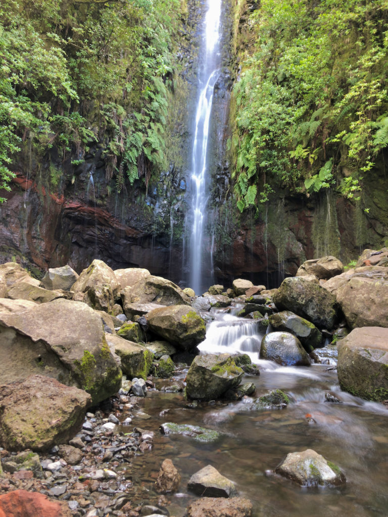
We parked the car at Queimadas and then walked the Caldeirao Verde trail up to a 100 meter waterfall. Along the way we went past a few smaller waterfalls and through a number of tunnels. The levada path hugs the steep mountainside with dramatic drops to who knows where below. The foliage is so lush that trees on the upper side of the trail drape over it, enclosing the path so that often you can’t see out. So the hike is perfect at anytime as you are shaded from the sun. Although it must get busy and the levada isn’t very wide. At times we had to straddle the levada with our legs to allow people to pass by. We both thought it was one of the most beautiful hikes we’ve taken. And we’ve done a lot of hiking!
Porto Moniz
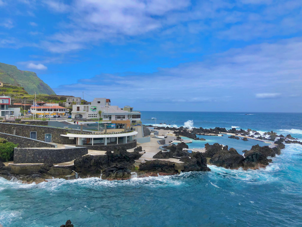
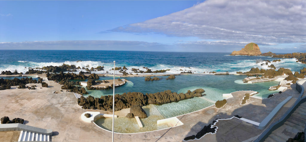
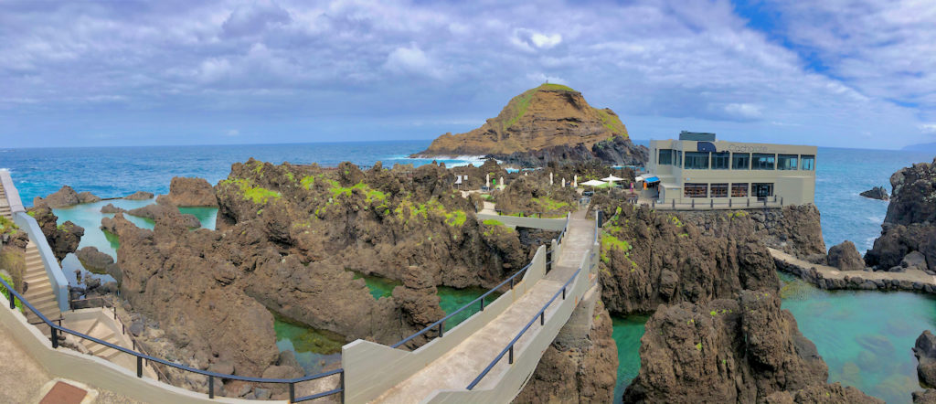
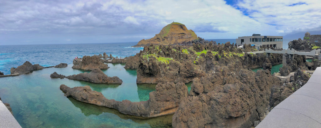
On Day Five we drove back down onto the VR-1 and headed west until we got to the north route through the mountains to Sao Vicente and then followed the northern coastal highway west to Porto Moniz. Our hotel, Aqua Natural, was situated right on the water and our room was not far from the pounding ocean. In front were naturally formed swimming pools in the lava rock. On our arrival it was overcast and windy so no one was swimming and we stuck to the jacuzzi they have inside!
We drove up behind Porto Moniz to do a levada hike high in the mountains called 25 Fontes. This one was a little strange. We had to walk downhill on a narrow paved road to the beginning of the hike, for more than a kilometer.
Once there we had some rock stairs to go down further. Finally we reached the levada and followed it for a couple of kilometers to a beautiful waterfall. But the walk down just took so much away from the hike as it wasn’t very scenic, and you had to walk back up it at the end of the walk. And it is supposedly one of the most popular Madeira hikes. We found Queimadas to be much more interesting with an even higher waterfall.

Disappointed, we remembered passing a sign saying “Levada da Janela” on the way up so decided to check it out. When we found it there was a sign on it that said it was closed. So we asked a few locals and they said they are currently working on it but since it was a Sunday there was no work underway and we could go. This was the the type of levada we were used to and it proved to be very scenic. The work they were doing was to clear up a few landslides that had happened after a few heavy rains. Most of it was now cleaned up except for replacing the hand rails. Along the way we could see that they’ve been planting indigenous plants, mostly flowering and in the spring the walk was really be something.
We walked for about an hour before turning around, a little tired after our previous two-hour walk. We returned to the hotel, stopping along the way at a viewpoint with a bar for a last Poncha. “Poncha” is the national drink of Madeira, made of a very strong rum (50 proof), orange and lemon juice and honey. Then it was back to the hotel for a massage and dinner.

On our last day our flight did not leave until 7PM. So we took our time returning along the southern coastline, hoping for some better weather as it had been somewhat overcast in Moniz. It seems that this is usually the case; clouds gather on the northern shore but don’t make it to the southern side of the island. Hence the need for the Levadas to bring water to that side of the island that doesn’t get the rains.
We drove over the mountains again and followed the coastal road back to Funchal and eventually to the airport. There were numerous viewpoints along the highway on the southwest side of the island, where the shoreline drops off dramatically.

It was the levada hikes that we enjoyed most during our time on Madeira. Over our seven days we enjoyed five hikes, three of which followed a levada. During the 16th century the Portuguese started building levadas or aqueducts to carry water to the agricultural regions in the south. As Madeira is very mountainous, the building of the levadas , often using convicts or slaves from Africa, was difficult and dangerous. Many of the mountains have a nearly perpendicular cliff face and onto this the levada builders had to cut away a path to carry the water. The water then was used for windmills for sugar cane cultivation but after the stagnation of the sugar industry the levadas were hardly developed or maintained. But then the Madeirans came upon another use for them – hiking paths for tourists. Today there are about 200 levadas stretching 2,200 km with 40 km of tunnels with some now also being used to provide electricity from hydro power.
Our Five Hikes
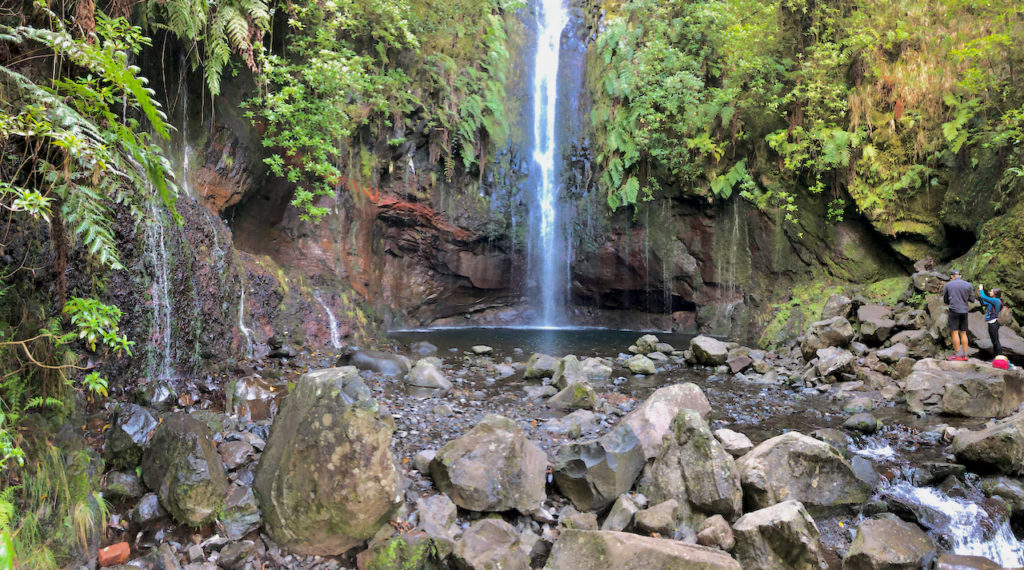
Levada do Caldeirao Verde (PR9)
This hike is just north of the town of Santana, beginning in the forest park of Queimadas, and our favorite. Leaving Santana the road is well marked in order find it. From the park there are signs posted for the Levada do Caldeirao Verde. It is an easy walk with a moderate incline, just enough for the water to flow through the levada. The hike is extremely scenic with lush green vegetation that often covers most of the trail as the forest trees create a canopy, blocking out the heat of the mid-day sun. Occasionally it opens up, providing spectacular views looking northwards towards Santana. There are three tunnels to pass through, one rather long so be sure you have a flashlight or an app for one on your phone. And keep your head down as the height can get quite low! The cauldron you arrive to at the end of the hike has a 100 meter waterfall descending into it, and is quite spectacular. There are a few other small ones along the way, but nothing like this one. The hike is about 10 km in length there and back and takes about 2-3 hours to complete.
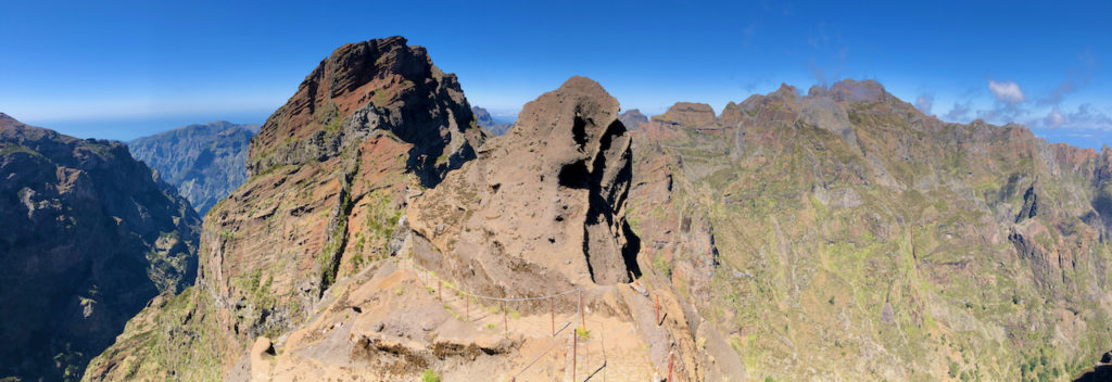
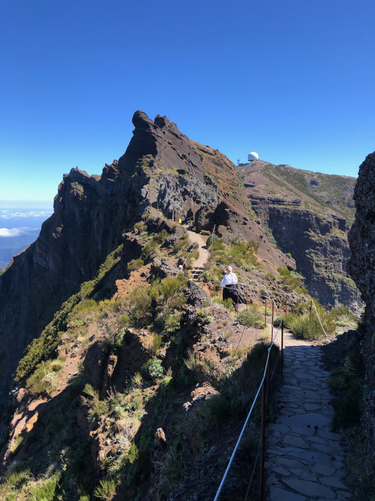
Pico do Arieriro (PR1)
This is one of the hardest hike on the island, beginning at Pico do Arieiro (1818 m) over to Pico Ruivo (1862 m). It’s quite challenging walk for those who are afraid of heights or in poor physical shape as there’s lots of ups and downs and difficult, steep stairs). The views along the way are amazing, and if the clouds have rolled in you are usually above them. To make the hike to Ruivo and back is quite a ways and, taking your time for pictures and rests, it can take up to five hours to complete. On some parts you are walking along the peak of mountain ridge that drop off significantly on either side. Fortunately it is well secured with guide wires, but still, it is not for the faint of heart. It sure does make for some great views and pictures, though. Where the levadas have rich vegetation, up here there is little, it is just rock. But that just ensures that the views are not impeded.
Levada das 25 Fontes
This is known as the most popular levada hike on the island, but we were really not that impressed. There is the waterfall at the end which is impressive, but we actually preferred the one on the Caldeirao Verde hike, which we also found the foliage and hike itself more dramatic. What really turned us off was that a good portion of the hike is walking a narrow paved road for quite a ways, before the hike even starts. And then having to walk all the way back up it when you’ve finished the hike. And, as it is so popular, there were quite a few people on the trail, especially the day we took it which was a Sunday. In our opinion, there are much better hikes. The hike is about 10 km and takes 3-4 hours to complete.
Levada da Janela
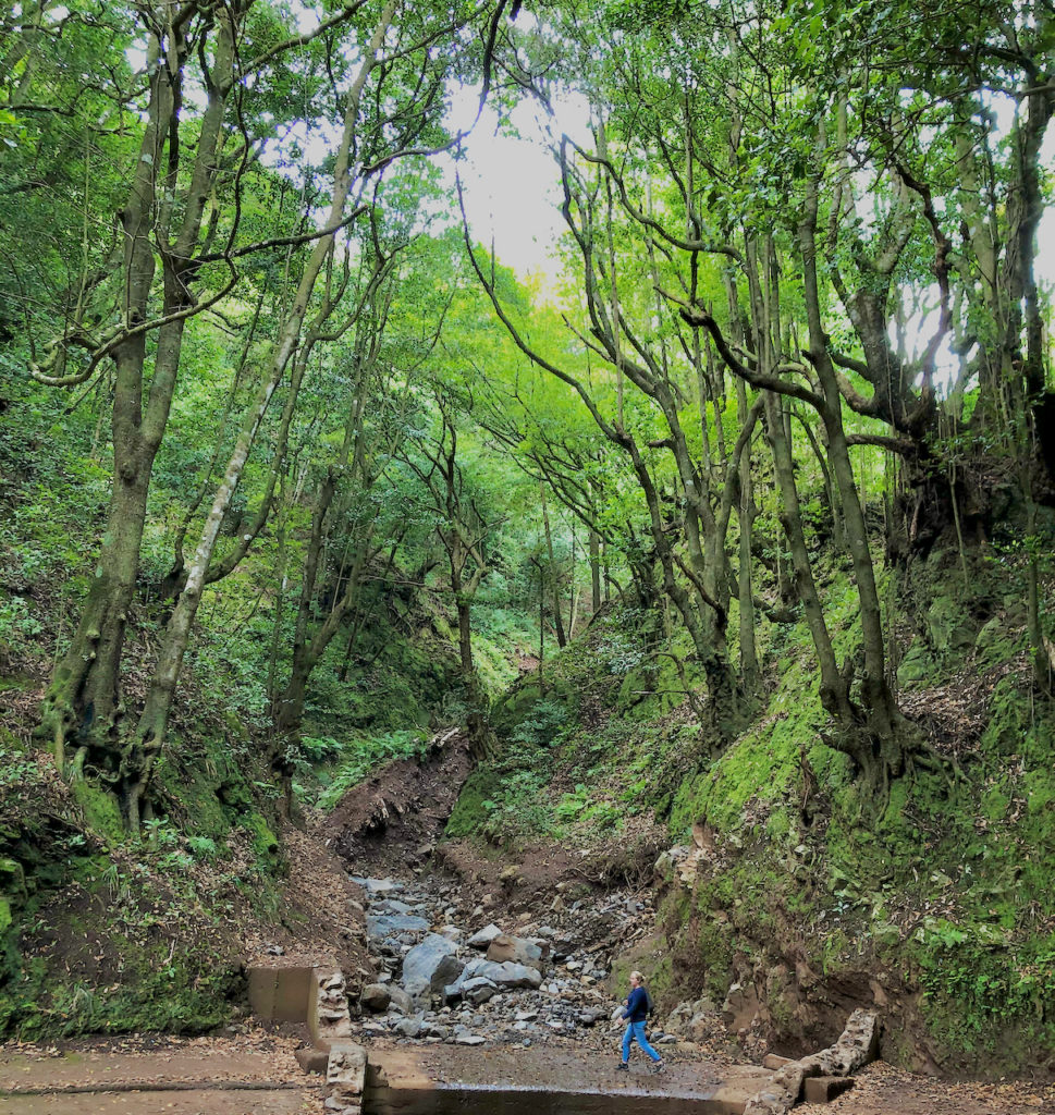
We stumbled upon this levada on our way back to the hotel after just finishing the 25 Fontes Levada. It lies just outside of Porto Moniz in the town of Lamaceiros and follows the Janela river valley. There’s good signage along the highway to find it and there’s parking available right where the hike begins. It’s a moderately easy hike, although long, with just a slight elevation, but it is quite scenic and very well taken care of. They’ve added plants and trees natural to the area along the path that passes through old and new forest. The trail goes on for 13 km until you reach the upper part of the Janela valley, with views looking back down towards Porto Moniz.
Vereda da Ponta de São Lourenço (PR8)
This hike goes through part of Madeira’s natural park, situated on the very eastern point of the Island. The land is quite barren, except for many colored flowers, and quite dry, which means unimpeded views. It makes its way across the peaks of a narrow piece of land that juts out into the ocean towards the African mainland. So many incredible viewpoints along the way. A somewhat challenging hike, but well worth it. There are dramatic cliffs and pillars of rock jutting out of the ocean, making for a very photogenic hike. It can be windy, more windy here than on any other part of the island, and when you are climbing and fighting the wind, it gets a little tough. So bring a windbreaker, and suntan lotion as there isn’t much to hide you from the sun. The hike is just over 7 km there and back. This was definitely a favorite of ours.
There’s many more hikes to take, and you can find many of them on this site: https://walkmeguide.com/en/madeira/trails-list/, and this one: https://www.journeyera.com/madeira-hikes/
If you want to check out the weather before or during your trip, check out these webcams situated around the island. It’s interesting to see how it can often be cloudy and rainy in the northwest of the island, while sunny and blue skies in the southern side.https://www.netmadeira.com/webcams-madeira
Great article on Madeira, my birthplace. Live in California USA and visit Madeira every 3yrs or so. Will hike a couple levadas from your list on my next trip. Thank you.
Glad you enjoyed the post Martin. And loved your island! We can’t wait to go back.